
The content on this website is published in English. I cannot guarantee the quality of the translated text generated by the plugin of this website. The machine-translated “names” and “terminology” are often inconsistent and/or incorrect. If it looks confusing, please switch back to the English version.
A long article, but hopefully it is informative and interesting; the read to test your patience and endurance, something you need to hike happily in Taiwan.
The Rugged and Humid Taiwan: the key facts about the hiking safety
The Terrain:
Taiwan’s land size is smaller than 1/7 of New Zealand and 1/10 of Japan; 70% of the land is mountainous but the majority of 23-million population live in the rest of the non-mountainous areas. If some solitude is what you are looking for in Taiwan, going to the mountains is a great choice.
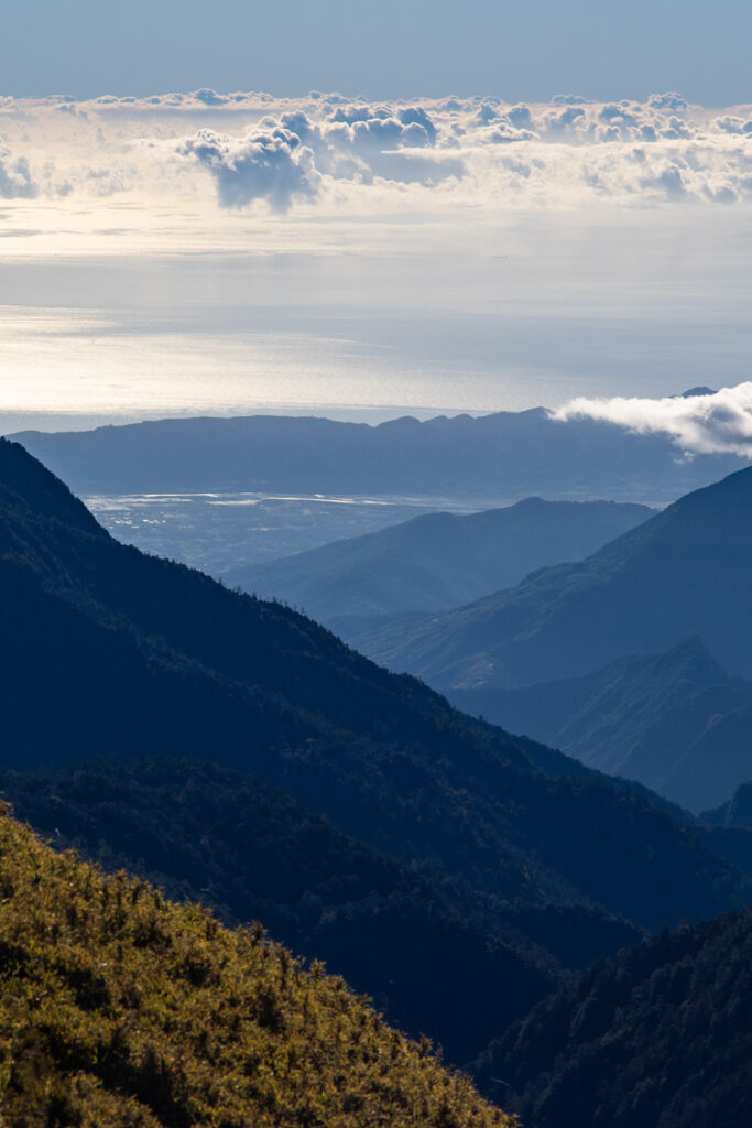
The terrain of the main island Taiwan is steep and rugged. I recently had some interesting measurements out of curiosity. If we draw a straight line on the map from the highest peak in Taiwan, Yushan (or Mt. Jade 玉山) at 3952 m, to the west coast in Dongshi (東石), the length is around 84 km and it is a 55 km line to reach the eastern coastline in Fengbin (豐濱); also Yushan is only 53 km away from the train station in the nearest city, Chiayi (嘉義市), where is a little bit higher than sea level (< 100 m). A more dramatic example can be found at Mt. Qingshui or Qingshuidashan (清水大山 elevation 2408 m), a well-known mountain in Taroko National Park. Its summit is just within 4 km to the Pacific Ocean.
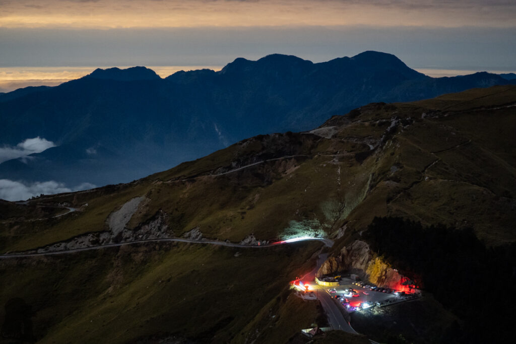
If you are a road trip lover, driving from Taichung High-Speed Rail Station to Wuling (武嶺) at 3200 m, the highest spot in Taiwan that a highway (14甲) can reach, may only take you around 2 hours according to Google navigation. You will pass through the suburbs of a metropolitan area, a big and busy basin, a few indigenous towns along the winding highway before reaching the alpine altitude. Probably not many other routes in the world can offer such a great altitude gain, scenic and cultural diversity with easy effort.

The Mountains:
A commonly used but not a precise classification for the mountains in Taiwan is based on their heights, not the difficulty to climb them.
There are:
Low mountains or foothills (郊山):
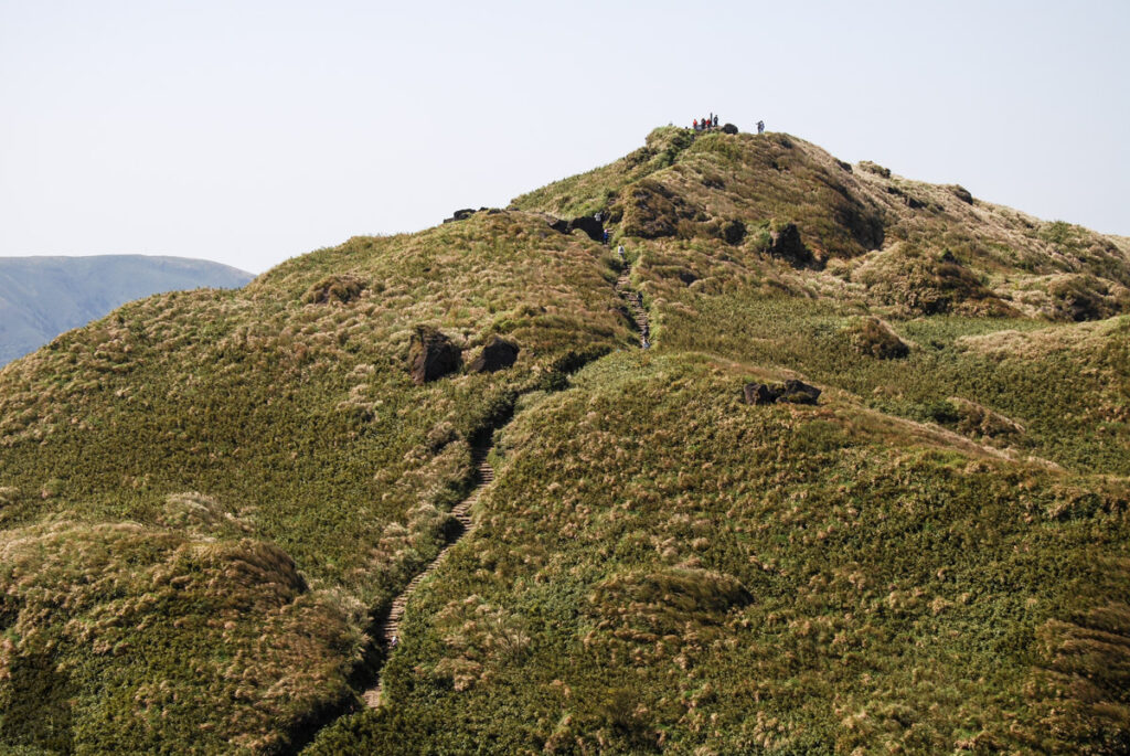
They are the mountains, hills or ridges shorter than 1000 m (or up to 1500 m), located in the outskirts of cities or towns that an ordinary people can finish a hike in a day. These routes are the ideal choices for travelers, photographers or novice hikers, but the complicated network of the routes in these mountains can be confusing even to locals. Search and rescue in the mountains of lower altitude is not uncommon in Taiwan.
High mountains (高山):
The general definition for a high mountain in Taiwan is a mountain taller than 3000 m (or more loosely, higher than 2500 m). There was a meaningless debate about the exact number of peaks that are higher than 3000 m in Taiwan; One of the versions was 268. I am not certain if all those elevation points are named by following a formal standard but the density of high mountains on this small land is remarkable in comparison to the numbers, 21 in Japan and 26 in New Zealand.
In 1971, a pioneer Taiwanese mountaineer, Lin, Wen-An (林文安), proposed a list of 100 mountains, which were taller than 10000 ft., already had names and trig points, as Baiyue (百岳), meaning the One Hundred Mountains. They were considered as the most representative high mountains in Taiwan. This list was very influential to date and it prompted many enthusiastic hikers in the following decades to climb all these mountains. Nowadays most of the routes to Baiyue are fairly clear on the map but their conditions vary substantially. Some are regularly maintained by national parks while others are just the impact trails after hikers’ footsteps. There is abundant information on the internet but not so much of it is in English. The main proportion of the photos and videos from Taiwan on this website was shot during the hikes in the high mountains.
Mid-rank mountains (中級山):
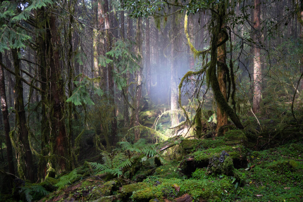
Their heights are roughly between 1000 m to 3000 m. Many of them are the remotest, the least-visited, the Taiwan version of untouched Amazon jungle. If you have a multi-day hike to high mountains you are likely to pass this altitude range a few times while moving between peaks. For those mid-rank mountains distant from popular hiking routes, there may be no visitors in a year or longer. Given the complex terrain, dense vegetation, lack of information and changeable weather, only the most experienced and skilled mountaineers are willing to explore this dark zone occasionally. Although the environment there is not friendly to hike and take photos but I wonder there must be hidden jewels in it.

The Rainfall: hikers’ biggest concern!
The average annual rainfall in Taiwan is around 2500 mm. But the spatial and seasonal variations is considerable. In general, the precipitation is higher in northern, northeastern and mountainous areas than the rest of Taiwan. In some locations, the annual precipitations were more than 4000 mm whereas a part of the west coast is the driest place where the annual rainfall may be lower than 1250 mm (Fig. 2-10).
Heavy rain caused by typhoons, fronts and southwesterly monsoon accounted for the majority of the annual rainfall in Taiwan. In 2009, a weather station in Alishan recorded a 3060 mm precipitation in only five days during the impact of Typhoon Morakot, an amount that is over the average annual rainfall. Similar but less extreme events occur several times in Taiwan each year. These are just the examples to show that the rainfall distribution throughout the year and regions is very uneven.
Rainfall not only wets hikers or spoils the fun but it is highly related to important hiking hazards and natural disasters.
Raining is the top concern that all hikers care about when making a plan and the decision, to go or not to go! Actually all veteran hikers in Taiwan are always prepared for “a raining day.”
The Hot and Chilly Weather
The Tropic of Cancer runs through the middle of Taiwan; as it is a tropical / subtropical region, people might think Taiwan a generally warm place. This is “generally true” for visitors who are used to see a lot of snow in winter. They may feel hot and humid when just stepping outside the airport terminal. Or people from tropical countries may find it not much different from their hometown. But this first impression can be very misleading once starting planning a hike, especially if that route is in alpine area.
Please be aware the altitude may rise quickly within a short driving distance in Taiwan. The lowest temperature ever recorded in Taiwan was -18.4 °C at Yushan Weather Station on 31st January, 1970. Even this is an extreme record in Taiwan but a low temperature such as -5°C is not something unusual in some high mountains during a winter. The 0°C to 10°C range is common at an elevation over 3000 m. Here is the table for the monthly average temperatures of some weather stations across Taiwan. The figures of Yushan are in the second row from the bottom of the list. For people who want to dig in seriously, click the link to the database of Central Weather Administration.

The 22 things you need to know:
Hiking in Taiwan may be very different from other countries! Some hiking tracks are suitable for most visitors but many more should not be treated lightly.
I am not an expert on mountain safety or mountaineering but the following content are the knowledge, the principles and the experience that I learn and adopt to keep me safe when hiking in Taiwan since 2010. Even you are an experienced hiker, there might be some useful information.
By reading through all the Q & A,
You will have a general idea that how and where to assess the weather; how to improve the fitness in preparation for a challenging hike; how to minimize the risks associated with a hike; how and where to gather information for a hiking trail and the legal aspects to hike on a trail in Taiwan; how to contact other people when you are in the mountains.
The weather in Taiwan: Q1 and Q2
(Alert: this is not a meteorologist’s point of view)
Q1: Which are the popular weather forecast websites among hikers in Taiwan?
Central Weather Administration (中央氣象署) is the official agency in Taiwan which provides the weather, marine forecast and earthquake reports.
There is a Mountaineering page which shows the weather forecast for popular mountains.
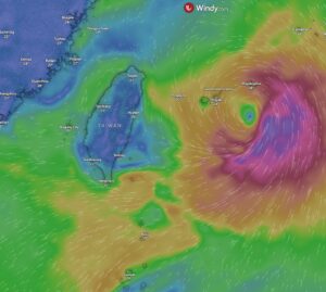
“Windy: Wind map & weather forecast” has a user-friendly interface and well-designed visuals. The most handy function for me is that I can get a weather forecast for any location on the map and I always turn on the meteogram to see more details such as the cloud cover. I can also compare the forecasts from different models. During a typhoon season, I often used wind layer (or others) and check the timeline for the next few days to watch if there is anything (or maybe I should call it a weather system?) spinning counterclockwise as it may indicate a tropical depression or a typhoon. If that circling thing occurs near Taiwan or may move toward Taiwan, I would be highly alert to it.
I always interpret the forecast cautiously as it may not accurately tell the condition of a micro-environment, which can be a ridge or a gorge that is along the hiking trail. In October 2024 my partner and I hiked along Ruisui Forest Road (瑞穗林道), the first section of South Section 3 (南三段), Central Mountain Range. In the morning of the first day, the weather forecast said 30% probability of rain, but it actually rained for entire two days since we were dropped off, forcing us to abort the hike reluctantly. Then I was told that there was a tiny patch of cloud on the radar which stayed right on the top of our location. On another hike, I was lucky to receive only a few raindrops as I expected to be under the pouring rain all day long when the forecast told me the probability of rainfall was 70%.
Different forecast models may give you different prediction for the coming weather and even the same model may generate different results within a day. I am unable to make a comment regarding the accuracy of those models. But if the bad weather you are watching is related to a typhoon (or a tropical depression), southwest monsoon (southwesterly flow), a stationary front or a strong cold front, you have to be very conservative and consider the worst case scenario. They result in extreme weather which strands or kills hikers every year in Taiwan.
Q2: What would be the best time to hike in Taiwan, in term of weather condition?
This is a big topic. There are fine days for hiking in each month but there is no season or a month free from any adverse weather. The weather is also location-dependent. While the northeastern monsoon impacts Northern Taiwan, causing heavy rainfall there, the Southern Taiwan may still enjoy the sunshine at the same time.
But knowing the seasonal pattern might be useful especially if you are planning a multi-day hike. Please note this seasonality has some variation each year. The following content is rough and descriptive, just my understanding for the climate in Taiwan.
From December to March of the next year:
Watch out for the winter condition and the influence of cold fronts!
This is the cool period in Taiwan. Hiking at lower altitude is no longer a pain on a sunny day.
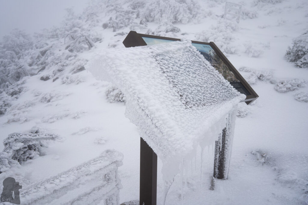
From time to time the winter conditions, snow, ice and frost, may occur in alpine areas above 2500 m, particularly when the northeastern monsoon visits Taiwan. Cold air mass and moisture together result in snowfall at high altitude. If the cold front is strong, occasionally snow falls down to a low altitude in Northern Taiwan like Yangmingshan in Taipei. Some high mountains such as Hehuanshan, Nanhudashan, Xueshan and Yushan (and many other more) are well-known to have snowfall.
The Northern, Northeastern and Eastern Taiwan are the main areas affected by northeastern monsoon as well as the eastern side of Central Mountain Range. In addition to the possible freezing condition at high altitude, raining at lower altitude is common in these affected areas; heavy rain is possible. In contrast to this chilly and wet condition, the further we move toward the Southern Taiwan or to the western side of Central Mountain Range, the more we can expect a warmer and drier weather. Because many alpine hiking routes follow or traverse the ridges of Central Mountain Range, hikers on these trails should expect adverse weather while a cold front impacts Taiwan. Hikers may have a lower chance to encounter rain or snow if they hike in Southern Taiwan during this season but a nice weather in the mountains can not be guaranteed.
In each winter, Yushan, Shei-Pa and Taroko National Parks announce a period of time as “snow season” which requires more paperwork for applying an entry permit to hike on an alpine trail. It is to remind the hikers those risks related to the winter conditions and the safety precaution to consider. Many Taiwanese hikers avoid going to alpine trails, especially in January and February, mainly for safety reasons. In Taiwan, people see snow as the presence of beauty and danger.
February to April is the duration of spring rain which rainfall increases substantially in Northern Taiwan but it still remains relatively dry in Southern Taiwan.
April
My favorite month
The days become warmer gradually with some chances of cold front still coming to Taiwan in April but less likely to cause snowfall. There might be a little bit snow not melted away yet on the alpine tracks or some morning frost on your tents. I find that April might be a good month to organize a multi-day hike in high mountains as it is reasonably warm but not so hot to have frequent afternoon thunderstorm; it is also the month still away from the coming rainy season.
May and June
The so called Plum Rain Season (or Mei-Yu Season) occurs during this time. When a stationary front lingers in Taiwan, it often brings a massive amount of precipitation to the whole island. Hiking under downpour for days is absolutely a physical and mental torture. The risks result from swelling rivers and landslide increase. There are still windows between raining days that you can hike comfortably but the weather can be pretty hot at low altitude since May.
June to September
Watch out for typhoons, southwesterly flow (southwest monsoon) and be ready for afternoon thunderstorm
When the Plum Rain period ends, it is the summer time. Hiking under the unforgiving sunshine in summer is tough. It can be very warm even in high mountains. A common summer day in the mountains may begin from a sunny morning with clear blue sky and maybe some clouds. With the rising temperature, moisture turns up from the valley and hikers may be walking under growing mushroom-like clouds (cumulonimbus) or in the fog starting around the midday. When the time comes, the giant mushrooms in the sky begin releasing their reserve. The pouring rain falls accompanied by thunders. The rain may last from minutes to hours. Eventually it eases off and the sky is cleared again in the afternoon or later. An ideal schedule in summer is to set off early in the morning (even well before the dawn on a big day) and keep finger-crossed that you are already in a shelter before the rain strikes.
In average three or four typhoons affected Taiwan each year, where 78% of invasions happened between July to September. Typhoons bring life-threatening situations to all hikers if they are unable to get away the mountains or hide inside a solid shelter in time. Once a typhoon is close enough, it affects the weather of the whole Taiwan; none of the hiking trail is safe. On top of the typhoon itself, the interaction between a typhoon and southwesterly flow (accompanied effect) can cause disastrous heavy rain. If a hike may take more than four or five days during a typhoon season, hikers should check the weather forecast every day as a tropical depression may arise fairly near to Taiwan and becomes a typhoon shortly.
When a typhoon is gone and even the rain has stopped, mountains are still hazardous because there may be flooded rivers, landslips, or damaged tracks.
Once a typhoon warning is issued, national parks will immediately close all the trails and all hiking permits become invalid. The trails may be open or remain closed after the rangers have assessed their condition. For other hiking routes outside the national parks or not managed by any other authorities, there may be no official update for their current condition. You can inquire Facebook hiking group page or get the latest information from this FB group.
October and November
The probability of a typhoon approaching Taiwan is lower in this period, but still possible; it is important to check the forecast for any sign of a typhoon.
The air temperature generally cools down but sometimes it remains hot at low altitude. Northeastern monsoon begins their influence on Northern and Northeastern Taiwan while the Southern and Western Taiwan enter the dry season. Many hikers have their multi-day hikes during this time when there is less chance of typhoon, afternoon thundershower and snow.
Here are more official resources if you want to know more about the climate in Taiwan, click to read here and there.
Source: windy.com
Fitness for Hiking (Q3 to Q6)
Q3: Do I need a good level of fitness to hike safely in Taiwan?
Yes or No! There are various hiking routes in Taiwan suitable for people with different levels of fitness. They range from day walks to challenging multi-day hikes.
The level of fitness required to hike is also depending on the level of your self-sufficiency. For a solo hiker who wants to hike on a multi-day route without any shelter on the way, this person needs to have a higher standard for the fitness. If you join a group with a hired guide and porters, you can save a lot of energy by their service.
If you are not used to hike in a hot and humid environment (> 30°C, RH > 70%), which is very common at lower altitudes in Taiwan, you may find that you are getting tired quickly under this condition. This is another aspect to consider when assessing the fitness for hiking.
In my opinion the fitness, the strength and the endurance, is never enough in the mountains. Money can be useless in the mountains but a good level of fitness always helps.
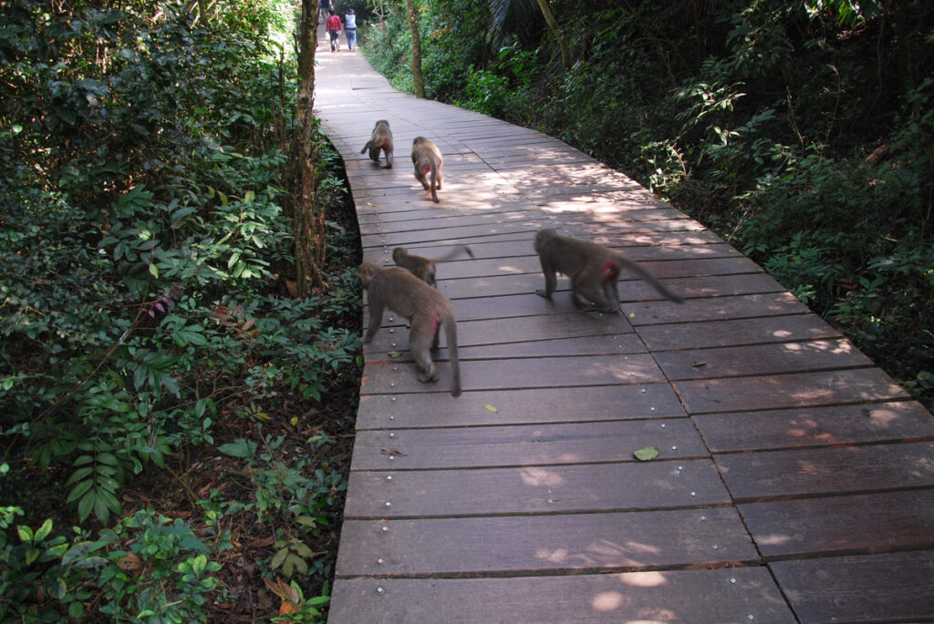
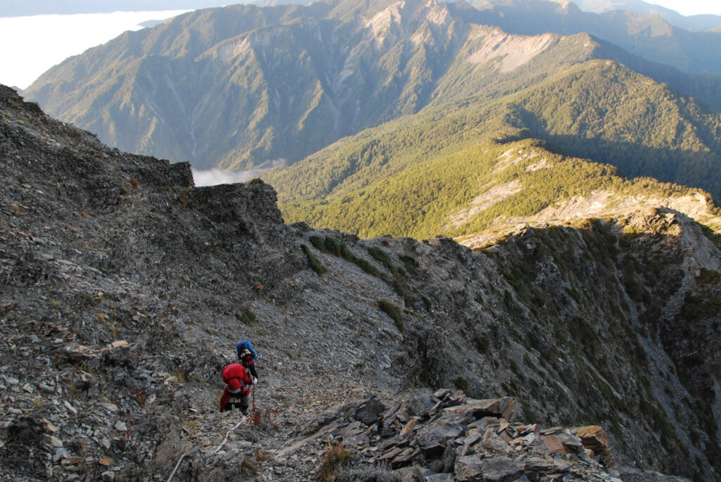
Everyone would agree that the stroll on boardwalk in Shoushan, Kaohsiung (高雄壽山) must be way more easier than the climb to Zhongyangjianshan (中央尖山) via the “Death Ridge” (死亡稜線). But I would endure the exposure on the Death Ridge rather than the heat on a summer day in Shoushan.
Q4: I am not experienced in hiking, what are the recommended exercises if I want a multi-day hike?
Jogging, biking, weight training or many physical activities are all good to build up some strength and endurance for hiking. But they are not a hiking-specific training. The best way to improve fitness for hiking is hiking.
It is helpful to have an easy day walk before trying a challenging hike or to go for a two-day hike prior to any longer ones. These are the easier versions of our bigger goals. They provide chances to examine if any condition occurs during the process and whether our routine exercise pays off. Some specific discomfort may only appear after long hours of walking, climbing, descending and confronting poor weather, the situations we rarely have from our daily activities.
I find walking on a short and steep (but not extremely steep) hiking track with a heavy backpack is an efficient way to boost the general fitness for hiking. It acts like a simulation for a longer and harder route in a more controlled environment. If an exercise like this is not possible, walking up and down the stairs with a weight on the back would provide similar benefit but not as much as from a real hiking track.
In the beginning of my hiking experience in 2010, even a 5-kg backpack could make my upper back sore in several hours. An X-ray film and some physio treatment confirmed that nothing broken in the bones or muscles, jut the pure weakness. To train my back and shoulder I started a program, an easy stroll for an hour each time, maybe three times a week, with a 5-kg pack for the first walk. Then my backpack became a little bit heavier week by week. I also intentionally kept the hip belt unbuckled to let my shoulder / back strained and adapted. The backpack reached 35 kg a year later and this weight did not result in obvious back pain in one hour. A sore upper back was no longer an issue for a multi-day hike since then if my backpack weighed around 20 kg. Even this program was done long before I knew anything about weight training, it naturally followed the principle of progressive overload.
I only hiked intermittently in recent years. About two or three months before a multi-day hike, I would condition my body and fitness into a hiking mode. By choosing an ideal track, I carried out the training program with the same principle. In my case, the Bridle Path in Christchurch, is the ideal choice. This track has a short but steep section which the elevation ascends about 250 m. It is a straightforward climb that I can train safely rain or shine (or even night and day if I want). But the gradient was still challenging when I carried 20-25 kg on the back for the first time. I usually completed two or up to three return hikes in a row along the same track. The training frequency was once a week, two or three times a month. Backpack weight increased each time I was there until it reached 35-40 kg, the upper limit I can safely handle.
To avoid unnecessary injury or slip, I wore the pack properly (hip belt buckled) and used two walking poles with the skill set to maintain the balance and preserve my joins. As this kind of exercise may take a toll on my knees in the long run, I only executed the program when I needed it.
A backpack of 40 kg may sound overwhelming and unnecessary, but this number is not the point. It is just an idea to know how much weight I can carry safely on a track for a short period of time. Different people would have very different capacity. If I can upgrade my capacity by a series of training, the more likely I can handle a physical load within my comfort zone during a hike. When an unforeseeable event happens in the mountains, I may still have some extra capacity to deal with it.


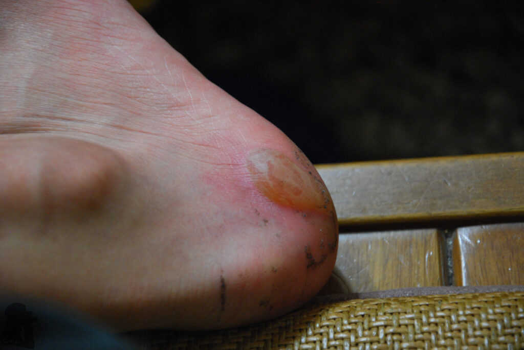
Blisters developed after a prolonged hours of walking is nasty once it happens. If your training is hard and long enough, you may have this kind of issue that never appears during normal days. I knew a hiker who was airlifted due to the excruciating pain after repeated beating on his broken blister under the foot. The upper photo shows a piece of the skin peeled off from the heel when I hiked on Nenggao-Andongjun Trail. I finished the hike in a tough way. Nowadays I definitely tape all the blister-prone spots on my feet with surgical tape before the hike. The tape does not guarantee blister-free, but when a blister occurs it may remain intact, at least in the case of the lower photo.
Q5: What are the essentials to pack? And some opinions about lightweight backpacking for a multi-day hike in Taiwan.
Lightweight backpacking is usually the concern if your hike will have three or more days. And the discussion about this interesting topic can expand to a long article but I would try to make my opinions simple and useful.
We can generally move faster and safer with a lighter backpack. And thus we can preserve more energy and time for the enjoyment from the hike and the scenery. While we endeavor to reduce the weight of out backpacks, there are a few things to think about, especially if we hike solo.
(This is not a comprehensive list; you need to have your own essential gear list)
Consider the cold and wet conditions in the mountains: hypothermia is a real threat to hikers in Taiwan. Actually this is a big risk that hikers should be aware and prepared for it. Once your clothes get wet in the mountains, it is very hard to make them dry again. In addition to a reliable tent, you should have water-proof jacket / pants, fleeces, thermal layers, sleeping bag, spare clothes and the bags to keep them dry. Also the fuel and stove for cooking, at least to boil water;
Navigation / communication devices: many hikers merely rely on their phones to do everything but in Taiwan there are many mountainous places which are out of cellular coverage. I still carry a Garmin device with the inReach function (satellite communication via text) for every hike. Low temperature reduces the battery’s performance. So one or more power banks are essential;
Spare food / snacks for one more day: if you are delayed due to a couple of reasons (e.g. a flooded river);
Personal hygiene / medicine and first-aid kit;
Head lamp: if you need to see and move in the dark or let someone see you in the dark;
Technical gears (only if they may be required): crampons, ice axe, sunglasses, helmet, rope…etc.;
Spare glasses: very important for me
When I first started hiking, I was told that a backpack should not be heavier than one third of my body weight; but it seems most of the advice says the weight should be less than 20% of the body weight.
As a skinny photographer and hiker, my backpack easily exceeded those recommended weights many times. For an 11-day hike, South Section 3, in 2025, regardless of the effort for lightweight backpacking, the pack still weighed nearly 27 kg. But because I had trained to deal with this weight, it was not overwhelming. If you do not need photography gears or eat as much as me, your backpack is supposed to be much lighter.
There are many situations which you have to carry heavier stuff in exchange of comfort and safety. For example, more thermal layers, a heavier sleeping bag and more gears for the winter condition; or more variety of food / snack for a longer hike.
There are also situations that your backpack’s weight increases when you are already on the track: Rain and dew can easily add some weight on your tent and backpack; your exhausted or injured teammates may need you to share some load from their packs; or you may have to carry liters of water with you because the next campsite does not have any source of water…
Anyway, lightweight backpacking should not be the solution for the poor fitness or the result from insufficient preparation. I try to train harder because I could not predict what would happen in the mountains.
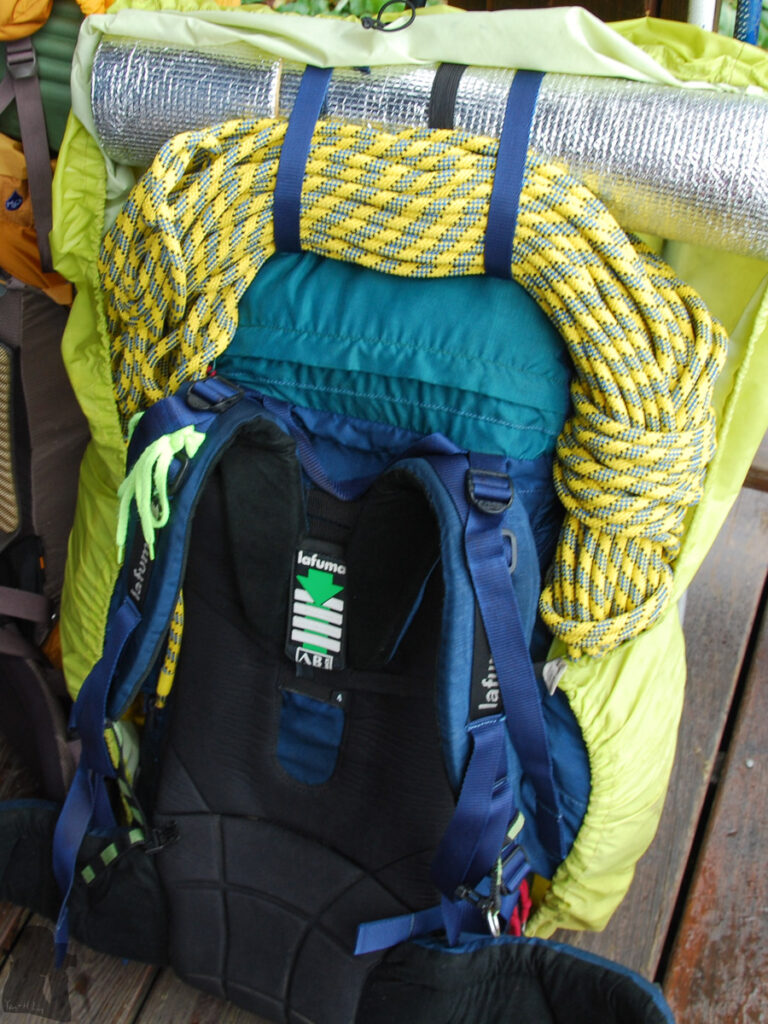
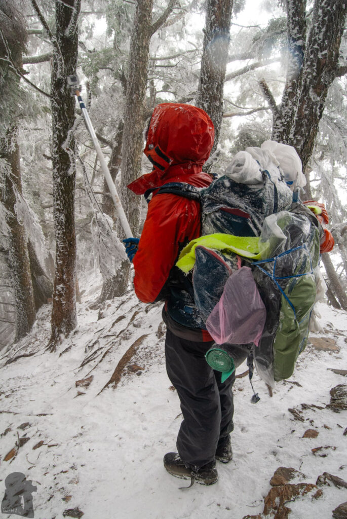
A 28-kg backpack for snow climbing training (up) in Xueshan and a 30-kg ugly one (down) for my wedding portrait shooting in Nanhudashan. If you have a special purpose in the mountains other than hiking, the backpack could not be light.
Q6: I don’t have much time to prepare for a multi-day hike, who can assist me in Taiwan?
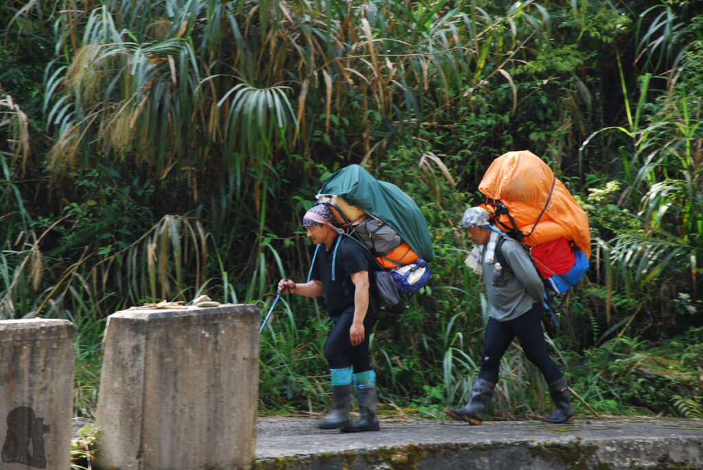
A simple way is to join or organize a group hike with a hired guide and porters (mountain assistant 協作) to take care almost everything for a hike. All you need to do is walking, eating and sleeping. The service is not cheap but it greatly save your time and energy and also minimize many risks during a hike. To be honest, I could not really give you any constructive comments in this regard as I only attended this type of hike once many years ago.
There are quite a few hiking service providers in Taiwan. You can book meals, guided hike or a custom hike with them such as this one (this is just a company I frequently heard but I did not have first-hand experience with them!). Many of their guides / porters are skilled and knowledgeable about their traditional territory.
Often this hiking service can take care of your tent, meals and even a sleeping bag. But it is very important that you must carry your own gears which keep you warm and dry with you all the time. If your tent does not arrive the campsite for some reason, at least you still have something to survive the night. Porters trapped by an accident on the way is not unheard-of in Taiwan.
There was a period of time I frequently joined guided hikes organized by different hiking clubs / associations. These hikes had one or more guides to lead the way (or even to cook for the team) but each teammate needed to carry a portion of the team’s supply / gears, to pitch tents, to get water and do other necessary chores to assist the guides. Before I hiked solo or only with my partner, I learned a lots from this type of activity which is more like a real hiking, rather than being a customer. The cost from this kind of hikes was much lower than the ones with full service.
Altitude Sickness (Q7 and Q8)
Q7: Is altitude sickness a concern when hiking in Taiwan? How to prevent it?
Yes, there were always some rescues for hikers who had serious altitude sickness and a few people were killed each year. The highest elevation in Taiwan is at Yushan, 3952 m, which is not extremely high in comparison to the world standard. But actually altitude sickness may occur at an elevation over 2500 m (But I assume this is more likely to happen to people who normally live at sea level). Given the well-developed highway system and the number of peaks that are taller than 3000 m in Taiwan, it can be quick and easy to reach this altitude range from the sea level in a few hours.
Some people may think a good level of fitness can greatly prevent altitude sickness. But to the best of my knowledge, a person’s fitness is not equivalent to the capability of acclimation to high elevations. The acclimatization to the low oxygen / air pressure environment is a separated matter and it is as important as the regular fitness training.
Some hikers in Taiwan tend to have a tight hiking schedule. In the early morning of the first day on a hike, they are picked up from a city at sea level and then have a huge and fast ascent by car and on foot during the following hours. They finally rest at a campsite of 3000 m high on the same day. This is a common situation where a proportion of people may get sickness because their bodies do not have enough time to adapt to the environment of a high altitude.
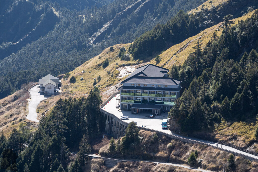
If the trail head is at a high altitude, ideally we can stay near it for one night before the hike to buy us time for the acclimation. For example many hikers stay in Dongpu Lodge (東埔山莊), at 2580 m, before the first day to climb Yushan; likewise Heishuitang Cabin, at 2710 m (黑水塘山屋), was my first overnight location on Qilaishan (奇萊山) Trails for several times.
Hehuanshan (Mt. Hehuan 合歡山) is the most convenient place in Taiwan to check how your body responds to an alpine environment. There are > 3000 m peaks near the highway where their trail heads can be accessed by public transportation or taxi. After the easy hikes (not including Hehuan West Peak) you may stay at Songsyue Lodge (松雪樓) or Ski Lodge (滑雪山莊) for one night to observe if you can maintain a good appetite and sleep well. If any sickness occurs during the stay, it is likely to descend via the highway to get a proper treatment.
When I stayed in Taiwan for a couple of months in the past few years, I tried to hike on alpine trails more than once a month. I guess the frequent hiking at high altitudes may keep my body at an acclimatized state although I am not certain how much scientific evidence can back up this idea.
Another way to prevent getting altitude sickness is to make your hiking plan according to a “normal” schedule of a hiking trail. For a multi-day trail, there are recommended daily schedule based on its mileage and difficulty. Faster and experienced people may finish the same hike in less days than average hikers, but they may risk themselves a greater elevation change in a single day.
Medication may prevent or treat altitude sickness. You can discuss your hiking plan and health history with a doctor to get an advice and a prescription. I carry my prescribed acetazolamide (Alert: some people should not take this medicine!) when I hike at high elevation.
Q8: I am feeling sick when hiking, but I am not sure if it is altitude sickness. What should I do?
Here are the principles I learned:
If you are at an elevation higher than 2500 m, you need to assume the symptoms like headache, nausea, fatigue, breath difficulty, loss of coordination…etc. are possibly caused by altitude sickness, even though you can not confirm it at this stage;
After some rest, if the symptoms persist or get worse, consider descending to a lower altitude. People may be reluctant to move due to the discomfort and weakness, but do urge them to descend if they are still able to walk.
Descend! Descend! And Descend! This is the most important and effective way to treat altitude sickness. Many people may have their symptoms significantly alleviated and even totally gone after descending to a lower altitude.
There are situations which make an immediate descent not possible when hiking a long alpine trail in Taiwan. For example, if you have been in the middle of an alpine trail where it needs several days to either return the same way or complete the hike; the nearest campsites or cabins are still at a high elevation; adverse weather; the difficult terrain which makes any off-trail descending dangerous and hard to be reached by search and rescue teams; or the sick person has become too weak to move. You have to avoid these situations by taking an action as early as possible.
In Taiwan many cabins have portable altitude chambers (PAC). These are the air bags which allow one sick person to stay inside. Air can be manually pumped into a PAC to make its air pressure similar to the condition at the elevation 1500 m lower than the current location. You need to find someone else to stay outside the chamber to pump and open the bag for you. I heard this equipment have saved a lot of potential casualty. However, many alpine trails do not have any cabins along the way and so I do not think there is any PAC there. Here is a useful article about PAC. It is important that after using the PAC, the patient still have to descend to a low altitude. Do not continue the hike.
If you think a rescue is necessary, call 119 or 112, or ask your emergency contact to help.
Click to read the guideline from Yushan National Park for more information about altitude sickness.
Descend to a low altitude is always the priority if possible.
Hiking Skills (Q9 and Q10)
Q9: Do I need any technical skills to do a challenging hike in Taiwan?
The hiking trails in Taiwan were developed for ordinary people, not for specialists. Many were historically used by travelers, locals and hunters for regular activities while others are for recreational or industrial purposes.
If the hike does NOT include the activities such as off-trail hiking, rock climbing, snow & ice climbing or water sports like canyoning, river tracing, rafting…etc., then hiking in Taiwan is not something technical in general (but non-technical does not necessarily mean easy).
If you are able to gather the trail information, weather forecast, have a basic level of navigation and route-finding skill to follow a trail, to safely move across all types of terrain with a heavy backpack and keep yourself warm and healthy during different weather conditions, you should be competent to hike in Taiwan.
There are several situations you may find a hike technical:
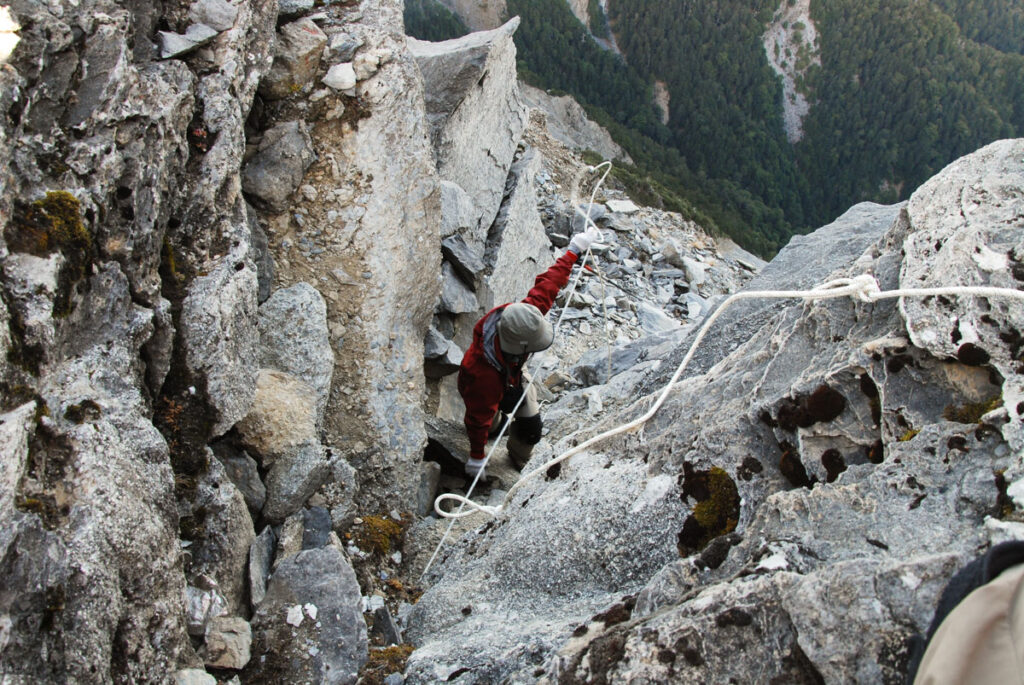
The most common challenge is to scramble the steep and exposed terrain. But as long as you are still on the trail, there should be fixed ropes, trees or rocks to assist you;
For a few hiking trails, river crossing can be difficult especially when heavy rain occurs. Gathering trail information, assessing weather condition and a correct decision-making are as important as the technique to cross a river;
Hiking on a snowy and icy trail at high altitude can be tricky and technical. Learning the skill to hike under winter condition takes time and practice to minimize the risk;
Occasionally if the track is newly damaged (usually by a landslip), it can be technical to pass a dangerous spot.
Some rope skill can be handy although it is rare that I really need to use my rope to do something. But if you know your hike will have river crossing or steep / dangerous sections to negotiate, maybe you need to carry a rope.
Q10: Is snow hiking possible in Taiwan? Any safety concern?
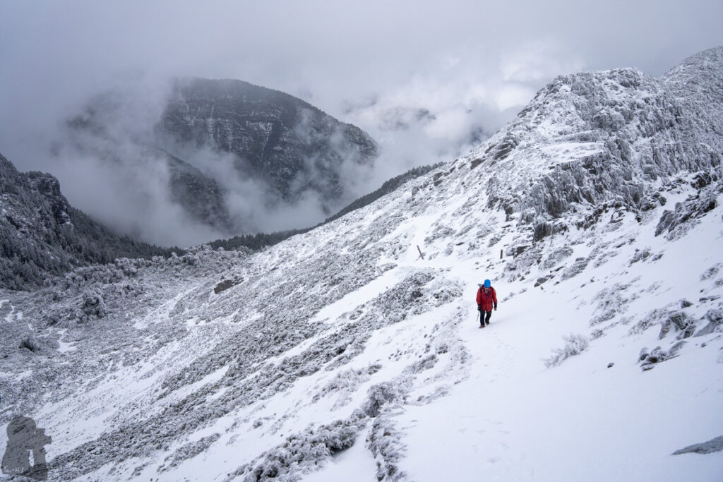
Yes! Snow and ice is probably the second biggest reason that deters a hiker from going for a hike in Taiwan (adverse weather is the top reason).
Almost every year there are a few accidents related to the winter conditions in high mountains. The most commonly heard are the fatal falls and the search and rescue missions for the stranded / missing hikers. Relative to temperate countries, it does not snow much in Taiwan and snowfall usually happens at high altitudes, away from highly populated areas. Generally, many hikers in Taiwan, including those experienced ones, are not familiar with snowy and icy conditions in the mountains. Some hikers would only hike in non-snowing seasons and some others may hike on the easier and shorter trails to appreciate the scenery and gain more experience from this beautiful and hazardous environment. I am belonging to the latter group.
If you are already experienced and skilled in hiking and climbing on snow / ice, you might skip this section. But if you are not an expert on this yet (like me), please do not underestimate the associated risks from the winter condition in Taiwan.
Many years ago when I had my first hike to Nanhudashan on 30th April, I heard hikers seeing snowfall on that day and I saw the snow on the track in the next morning. This late timing was really rare, but not impossible. But during most of the time in a year there is no snow / ice (but frost might appears) in alpine areas; so there is no permanent snowfield or glaciers in Taiwan. The amount of snowfall, like rainfall, varies substantially among alpine areas and also from year to year. It is up to how far a cold front could impact Taiwan during the northeastern monsoon prevailing seasons, air moisture and the local terrain. Although I could not find any statistics specific to snowfall in Taiwan, but if you can read Q1 and Q2 you may get some insight and the relevant information. If you watch the weather news or check weather forecast several days before your hike, you may see the information about the possibility of snowfall in high mountains.
In my opinion, the risks of snow hiking in Taiwan are usually from the slippery trails, the inexperience in using gears and the difficulty of navigation when snow covers the trails.
Hard snow and ice can make the trails and the ground below them very slippery. Even the easiest hiking trails in Taiwan may have the steepest slope on either side or both sides. And these normally well-formed tracks may become narrow or indistinguishable when snow takes over the space. A fall there can instantly cause serious consequences. Ice can form from rainwater or meltwater from snow but if you are aware of their presence you will definitely deal with it carefully. The most dangerous situation is from your unawareness. Ice may be hidden under a thin layer of snow. Or it can be a thin, transparent layer on the rocks (black ice), almost invisible. If a sunny day is coming in the morning, you may wait for some time while the black ice is melted away.
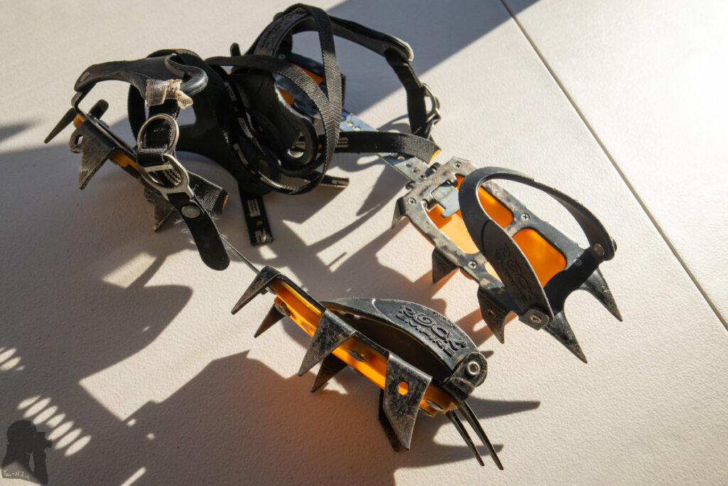
Inexperience in using snow hiking gears may be another cause of an accident on top of the slippery trails. In Taiwan most hikers already know that a helmet, crampons and an ice axe are the important gears when the track may become icy or snowy. But I wonder not many hikers had a proper training for using these gears let alone the proficiency; Some techniques like self-arrest or walking with crampons require many times of practices to become muscle memory; unfortunately it is not easy to gain enough experience in Taiwan due to the unstable snowfall and only the wealthiest and keenest group may go oversea to attend a mountaineering course.
Choosing the unsuitable gears also increases the risk. One common example is that someone uses footwear traction devices (micro-spikes) to hike on steep terrain. They are lightweight and easy to get on and off, but they do not provide strong grip on hard snow, ice or steep slope. If you want to use them, make sure you know their limit. I always carried a pair of mountaineering crampons (10 or 12 points) if I needed to move on snowy / icy trails. Their long points can penetrate into snow and ice securely and offer me strong grip. The drawback of using them is that you may trip over anything caught by your crampons from the bush to your pants. In fact I have broken my pants twice with them.
Snow can make navigation difficult. The trail may be hidden under the snow, increasing the chance of fall. The trail markers may be gone or become indistinguishable. Even the landscape appears very different from our impression. Those fixed ropes on steep and exposed spots may be buried or frozen. A normally easy hike now turns to an off-trail hiking. If an adventure like this is not what you want or you are not led by an experienced guide, please rethink your plan.
Snow blind and sunburn is possible if we let our eyes and skin unprotected. I always had my sunglasses with me on snowy trails even I did not need to wear them all the time. I got bad memory from sunburn on my face just after a day hike near Xueshan. My face including the lips started itching first and then peeled off two days later. Sunscreen should easily prevent this from happening.
The risk from avalanche is low. It occurred before but the relevant data is very scarce. I did not find any record of avalanche-related casualty. Actually it might be less and less likely to happen in the future as global warming is reducing the snowing days in Taiwan.
This is an article by a Taiwanese mountaineer if you want to know more about snow and ice climbing in Taiwan.



Navigation in the mountains of Taiwan (Q11 and Q12)
Q11: Is navigation / route-finding difficult in Taiwan? How to avoid getting lost in the mountains?
Navigation and route-finding can be tricky and sometimes dangerous in Taiwan when you leave a hiking trail for some reasons. Even not all but many hiking trails are located on steep terrain or / and in dense forest. By moving a short distance away from the trail you may either situate yourself close to a sheer cliff or leave everyone’s sight.
According to a statistics hikers getting lost accounted for the most common cause (37%) of the accidents in the mountains of Taiwan between 2015 and 2023. Although Taiwan is highly populated and does not have a huge land area, there are still many locations off the cellular coverage (please find Q20 for the coverage map). These are the areas where you may not be able to contact others to save you.
This section is about to follow an existing hiking trail, not the off-trail hiking or the expedition to seek a new route.
Here are my advice to avoid getting lost in the mountains:
1. Know your current location:
Although there are usually some signs along a popular track, but I highly recommend that you should have your own satellite-based navigation device. The coordinates of your location is the critical information if you are in trouble and need someone to find you.
There are various navigation apps but please install the ones developed for hiking and ideally they can support custom maps, the maps you can use without connecting to a mobile network. Please do not only rely on Google Map while you are in the mountains. It is useful to prepare a hike such as the satellite image for looking into the landscape feature and the Street View to find the car park or the trail heads. But Google Map needs a mobile network to be fully functional and essentially it is not developed for hiking.
When I hiked in Taiwan, I used Green Tracks (綠野遊蹤) with an offline topo map, Rudy MAPs (魯地圖). You can use them for free. Rudy MAPs is probably by far the most popular hiking map in Taiwan in recent years. It is detailed and has updates regularly. Rudy MAPs is compatible to different platforms and even has a version in English (but some of the translation are just the names’ pronunciation, so they probably do not sound meaningful.)
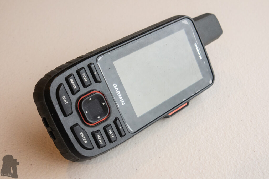
Even mobile phones have become the main tool for navigation among hikers, I still insist on using a separate device for this purpose because positioning and navigation are so important and I do not mind a small extra weight. My current model is Garmin GPSMAP 66i; it is an old, discontinued model but still work well as a navigator and two-way satellite messenger.
When the satellite signal strength is normal, the accuracy of your location should be within five meters. Sometime you may see your location drifting on the device’s map unreasonably and wildly even when you are not moving. In addition to a technical glitch, this is probably due to the local terrain such as a gorge, a riverbed, surrounding mountains, or dense forest that may hinder the satellite signals. The anomaly may last for several minutes or a longer time but it will be back to normal eventually. Having a second device to check the location is helpful in this kind of case.
I did not really learn to use paper maps and a compass for positioning and navigation. When all the batteries and power banks are dead, this is the traditional skill which can come in handy. But I assume it needs a reasonably good visibility to work. In Taiwan a good visibility is a blessing in the mountains. During a couple of years I actually carried paper maps and a compass when hiking, but the maps only functioned as a reading material when I was bored.
2. Stay / move on the trail:
Navigation and route-finding is not an issue when a hiking track is well-formed and signed. This is normally the case on popular trails. Following a trail becomes tricky when it is overgrown, obscured by fallen rocks, trees and landslips, too faint to be seen by inexperienced hikers or the appearance of a confusing side trail. If you are not experienced, you may accidentally follow an animal footpath or a trail not for hiking. Those may be a path only used by the hunters or locals, the trails to maintain pipelines / infrastructure, or a branch of a historic forest road. They are all common in the mountains. Veteran hikers can usually have a quick and correct judgment by recognizing some evidence for the right trail. However, it takes time to have a good sense for this.
Basically, when the hiking trail seems disappeared, faint or anything looking confusing, check your current location with your navigation devices first. This is to confirm you have not deviated from the route yet.
Besides the trails on the offline map, using one or more recent GPX files of the hiking trail to confirm your location can be helpful as the default trails on the map may be out-of-date. You can find and download those GPX files from Hiking Note (健行筆記) before your hike; There are heaps of track files uploaded by hikers. In addition to the newer posts, I would also download those GPX files with more waypoints, which often contain more useful information (e.g. water sources, small campsites, availability of mobile network) about the trail.
Now if you are still on the trail but just losing the sight of it or not sure where to go when a strange side trail turns up, stop first and look around to find any trail markers. Trails markers such as plastic tags / strips, reflective signs / plates are usually tied or pinned on the trees / shrubs; cairns may be found in the places without any plants or on the river banks to indicate the path for river crossing. These markers help hikers to avoid a wrong turn, to show where a detour starts or ends, to indicate the correct direction where the trail is narrow and faint and to remind hikers the presence of a trail junction.
On some challenging trails, the trail markers may be not regularly maintained or replaced. When searching for markers, look slowly and carefully as many only have tiny remains left after years of weathering. If you could not find any markers, try to spot anything artificial; these can be a branch with a smooth cut, slash marks on a trunk, and even the rubbish (sadly this is not unusual in Taiwan). Sometimes if you can manage to pass through a few fallen trees or rocks that block the way, the trails will reappear.
Occasionally trail markers can be misleading, especially those plastic strips, if they are not left at the right places along the trail. This may also happen if the old trail markers are not removed from an abandoned route. Even you have followed one or more trail markers, but when you notice the trail suddenly become unusually overgrown, too steep or too dangerous to pass, it is possible that you already deviate from the course.
Another common mistake is to totally trust the GPX track files on the navigation devices and assume you have to follow them exactly all the time. As a hiking trail may have some changes with time, especially after severe weather, there are some occasions that you have to make your own judgment and hike according to the current trail condition. Some parts of a route might have been gone due to landslide or become too dangerous to pass. Or there might be a new detour available. Your offline map or GPX files may not tell you these recent changes.
Please do not panic if you really can not see any signs of the trail. Do not proceed blindly. Go back to the latest trail marker where the trail is still obvious and then repeat the marker-hunting process. You might just miss an important marker or a hidden turn in the bushes within a short distance around you. If you or your team are feeling very insecure about this trail-tracking things, it is probably this route is too difficult to your current capability or it is simply because this trail is too broken to be passable. You may decide to stop and return the same way, a hard but likely a wise decision.
3. If you deviate from the trail, return the same way:
This is a simple and probably the safest method to find the way back to the trail. Hikers of all levels of experience may go off course from time to time in Taiwan. This is very common. However, many hikers are reluctant to return via the same way to fix this problem. It is probably due to a couple of reasons: if this happens during descending, they do not want to climb back to the trail because it is tiring; they attempt to take a shortcut to join the trail; they think moving along a topological contour or an alternative route is feasible to reach the destination even this is not their original plan. Given the complicated terrain, dense vegetation and the poor visibility in the mountains, losing the sense of direction or getting stuck somewhere dangerous are possible while you are struggling for a new way out.
If you carry on a deviated course, the further you move the harder you may safely return to the trail or get spotted by others. You should return the same way before it is too late.
4. The special circumstances that you might get lost:
There are other situations that a hiker may get lost, not only when traveling along the route.
A trail leading to the steep valley for water can be overgrown and obscured by dense vegetation such as bamboo. This is where hikers may make their own impact trails, making following a single, obvious trail more difficult. This happened to my friends and I once on South Section 1. We, three experienced hikers, could not return the same way to the campsite after filling our water bags in a creek. The space inside the bamboo jungle was literally a maze. We ended up pushing ourself through the dense bamboo shafts and made our way back on the straight line indicated by the GPS device.
Getting lost around a campsite is also possible. Many campsites of hiking trails are just the clearings in the forest / bush without any toilets. If you watch closely you may find one or more small trails leaving the campsites, these are usually so called “toilet trail” or “poo trail.” When you need the private space by following one of them in the dark, do not go too far and make sure you know the direction back to your tent. I got lost once in an embarrassing way after finishing my bathroom time in a bamboo forest. Being maybe only 20 meters away from the team, I totally lost my sense of direction and I could not see any tents from the bush. I had to yell to wake a guy who guided me back with his head lamp.
Since these lessons, I carry my navigation device with me all the time.

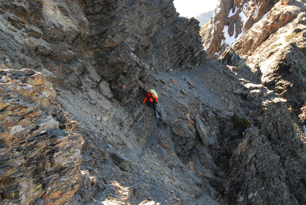

I took this photo because this marker is comprised of five broken old strips. Most of these strips may only survive for a few years before they turn to pieces.
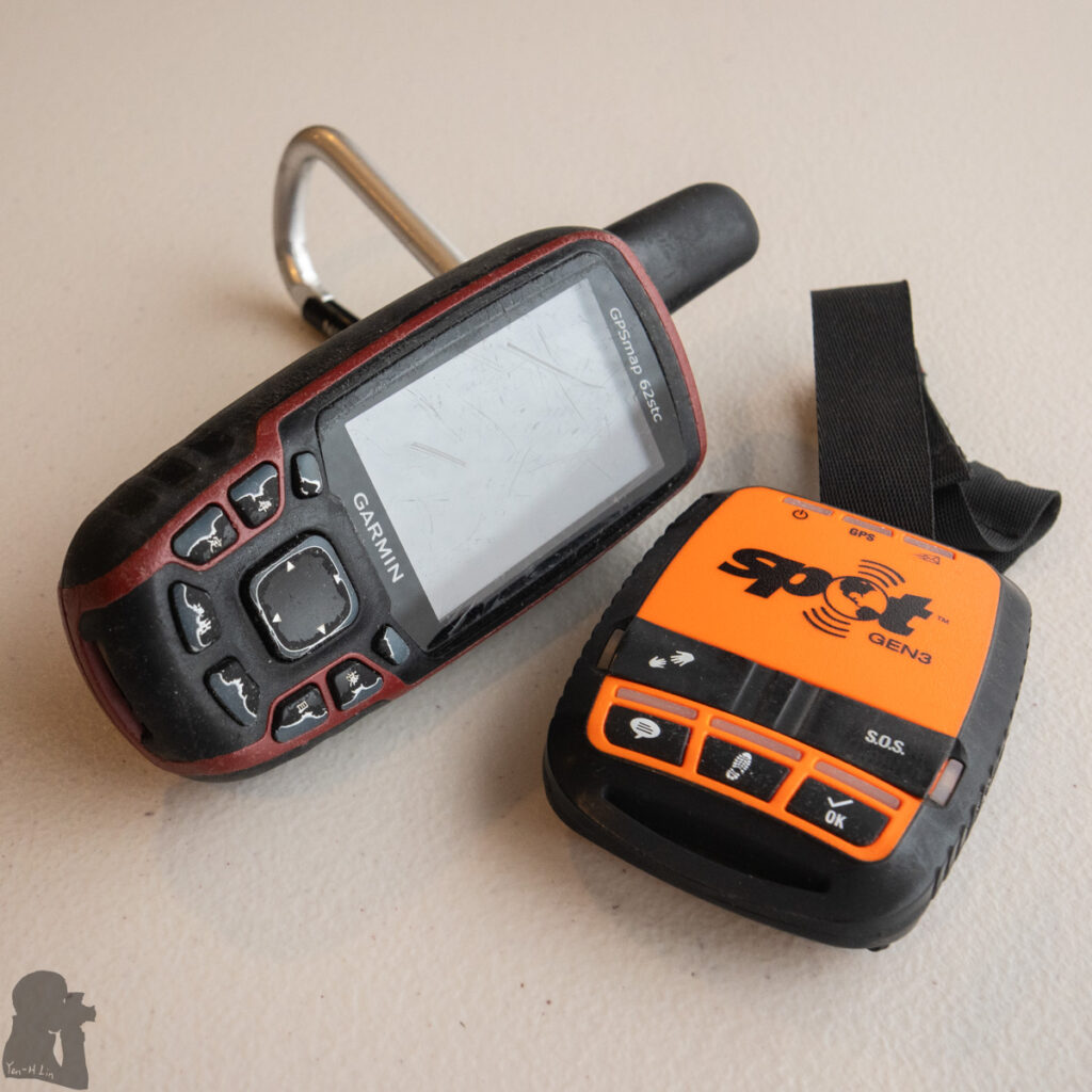
And Spot Gen3, the one-way satellite messenger, joined my team later in New Zealand. They were the perfect pair on every hike until a newer Garmin device replaced their roles.
Q12: I get lost in the mountains. What should I do?
When you realize you have been away from the trail for too long and too far and it is not possible to find the way back by yourself, you should stop moving. Unless your current position is not safe (very exposed, too cold, prone to rockfall…), otherwise just stay where you are.
Bear in mind the “Rule of threes”, also frequently called “333 guideline” in Taiwan: A person may survive three weeks without food, three days without drinking water but only three hours without a shelter in an extreme environment. In Taiwan, hypothermia is usually the result from the extreme environment in the mountains. Therefore you need to prioritize the tasks to increase your chance of survival. To stay away from strong wind and keep your body dry and warm is the most important priority! Being thirsty or hungry is painful. But actually I do not know if any hiking related fatalities were directly caused by dehydration or hunger in Taiwan; Hypothermia is a more imminent threat. Please read this section to prevent it.
If you are able to make a SOS call (119 or 112 in Taiwan), report your coordinates is very helpful. The coordinates is probably the most important information for search and rescue. Please make sure that you know how to find the coordinates from your mobile phone or navigation device. Searching for the missing hikers in Taiwan may take a long time, from days to weeks, if nobody knows where you are. The earlier you can be found, the more likely you can stay alive. Stay put, keep warm and contact someone are the three things which can save you. Please read Q20 to Q23 for information regarding the communication in the mountains.
If you are lost in the mountains, do not descend blindly. Do not try to descend by following a stream. Before you can reach a village or a plain, you are likely stranded by the common but dangerous terrains in Taiwan such as very steep and slippery slopes / cliffs, a waterfall or the poor visibility in the jungle. You may be exhausted or injured after the attempt. You may be further away from the mobile coverage. You will be hard to find by others. Moving along a river or descending a waterfall is very technical in Taiwan which requires skills, equipment and teamwork. Do not do this out of desperation.
In many unfortunate cases, missing hikers were found in a valley, near a stream or a waterfall. Maybe it is because people tend to descend to find water or just try to move away from the mountain when they realize they are lost. You should be aware of this risk when hiking in Taiwan.
Q13. What are the possible hazards when hiking in Taiwan?
This is a big section. But I hope you would not think hiking in Taiwan is very dangerous after reading through the content. This is just a list of the risks you might encounter in the mountains. Some risks are more possible to occur than others and some may cause more serious consequence. By understanding their existence you will have a better situation awareness and you can develop your own method to prevent, to handle and to remedy an undesirable or harmful result.
0. Your decision-making:
Some hazards are often connected to each other, if one of them occurs, the others may follow to aggravate the situation. Some serious accidents are the result of a chain of bad decisions, not just a single one. If you can remove one of the bad decisions, you may break the causality to avoid more negative results. The risk management and the leadership (if you are a guide) is a big topic.
Here is a simple example, a hypothetical case inspired by many true events in the mountains, regarding the hiking hazards and the decision-making.
Mr. 000 hiked under the pouring rain. He did not check the weather forecast before the trip. Even he was exhausted and wet, he still wanted to finish the hike. At the elevation 3500 m, he thought his headache and dizziness were due to a short sleep and the bad weather. He slipped and sprained an ankle at the spot where was normally dry and safe on the way to climb Mt. HuiShanNan. After the ascent to the summit, he fell down from the steep trail. Now he could not move at all with two broken legs and a spinal injury and his body temperature dropped quickly under the adverse weather. He tried to call 119 for the rescue but he was out of the mobile coverage. Mr. 000’s body was found 50 meters below the trail two days later when the weather turned calm.
Mr. 000 would have a better ending for his hike if he was more well-prepared or made a different decision after each unfavorable event happened. In this hypothetical case, the extreme weather, the slippery trail, the injuries and hypothermia are related. A single hazard may trigger more hazards.
Here are 11 types of hazards. It would be useful to think about how to prepare for a hike and how to manage a risk and so you do not need to deal with multiple hazards at the same time.
1. Bad weather:
Severe weather (too hot, too cold, too wet, and too windy) is not only a physical threat but also leads to a huge mental pressure to hikers. Bad weather often causes subsequent hazards in the mountains, not just the direct influence from it.
For most of the time, hikers in Taiwan care about either the typhoons or the heavy rainfall which can directly or indirectly result in many casualties everywhere. If you plan to hike at high altitude, snowfall / winter condition is another possible risk during a couple of months.
We can minimize this risk by checking the weather forecast and choose a hiking trail which might be the least affected by the adverse weather (although there are situations that no trails in Taiwan is safe). Hopefully the content of Q1 and Q2 can assist you to make a good decision. For more information regarding the risks related to snowfall, please read Q10.
Hikers may not consider the high temperature on a sunny day as a risk, but actually it is. Dehydration and heat exhaustion / heatstroke are very common in Taiwan, too common to appear on the news. I have not stayed in Taiwan during the summertime for a while. Besides the typhoons, I also worry about the heat. Even I grew up in Kaohsiung, I never got used to the hot weather. For me, hiking under the unforgiving sun is a torture.
Strong wind is a hazard as cold wind can increase the heat lost from the surface of our bodies (wind chill) and potentially leads to hypothermia. It also increases the chance of falls. In my experience I occasionally encountered the wind that was strong enough to shake me a little bit or added some resistance against me but not to the extent that I lost my footing. I saw my teammate’s tent blown away once and my partner and I had backpack covers taken away by strong wind before, but these were preventable if people secured the gears carefully. Even strong wind is not my most worrying hazard, but if you lose your tent when hiking solo, you may have a really big trouble.
2. Slippery trails:
The ground, footholds and handholds of a hiking trail can be very slippery in Taiwan. Slippery surface increases the probability of falls and injury, which is a considerable proportion of the accidents in the mountains. A fatal fall can kill a hiker faster than any other hazards.
Most of the natural environment in Taiwan are normally damp and warm and the steep terrain is everywhere. In addition to the possible snowy and icy conditions, basically the surface of the trees, boulders, soil, ropes, wood, concrete and asphalt may be wet and have lichens or algae constantly growing on them, making a trail super slippery. Also, there may be thick layers of pine needles / fallen leaves, mud, loose and unstable ground of landslips along the trails.
A pair of anti-slip gloves is always on my gear list for all multi-day hikes or for any day hikes requiring scrambling. They can protect my hands from unwanted cuts or sting by plants and keep my hands clean, if you care about the hygiene. In most of the cases, a pair of quick dry work gloves with grippy material coating can do very well. They do not have to be expensive. (But when hiking in winter or at high altitude, your gloves also need to keep your hands warm.)
There are some walking techniques which can help you to minimize the chance of a slip, such as using hiking poles, walking slowly and descending with smaller steps, lightweight backpacking…etc. If you see a hard surface, wood, rock, concrete…, shows a greenish color, you should assume that it is slippery. I would avoid treading on it. But if I have to, I would use the other foot / hand and poles to share out my entire weight. If you suspect a foothold unstable, do not shift your center of gravity over it.
Having a proper footwear is a hot topic among hikers in Taiwan. Periodically there are discussions about whether people should choose conventional hiking boots, trail running shoes or rain boots (gum boots) for hiking. There are pros and cons of each kind of footwear. And no footwear is suitable for all types of slippery trails and weather.
I wore hiking boots in the beginning and then changed to tall rain boots for a couple of years including the first few years in New Zealand. My footwear was back to ordinary hiking boots recently. But the hiking days in rain boots still accounted for the majority of the hikes I have done. Some hikers in Taiwan believe that rain boots offer better traction than hiking boots. But I wore tall rain boots to hike because they are cheap, easy to get on and off, water-proof and no need for gaiters. I admitted all the rain boots I wore before were grippy but there were hiking boots which provided a similar level of traction on the trail. Basically rain boots is not designed specifically for hiking or mountaineering. And actually it took me some effort to find the ideal model which fitted my feet, and the insoles, ankle supports and the socks to improve the comfort and safety for wearing the rain boots on challenging hikes.
It is really hard to say which type of footwear is the best one to deal with the slippery trails in Taiwan unless you really test them by yourself. But before a challenging hike, you should “break in” your new footwear by wearing it for an easier task. So you can have an assessment for its performance.
If you need to wear crampons on the boots, make sure they are compatible with each other. Not all hiking boots are suitable for crampons. You need to do some research and also consult someone experienced in this regard or you can attend a snow hiking course.
No matter how carefully you manage to pass a slippery spot, you may still slip. It is very common and totally normal. Even having years of experience I may still slip more than once during a multi-day hike in Taiwan. Luckily none of these minor slips caused any injury or dangerous scene.
There are other aspects you can think about to minimize this risk. For example, hiking when the weather is fine; a good level of fitness and coordination; enough sleep…etc.


3. Hypothermia:
Severe hypothermia can kill a hiker in hours. I would say this is one of the major causes of death in the mountains. Hypothermia can happen to people in Taiwan at different altitudes, not just in the alpine areas. But because of the high rainfall, low temperature and windy environment in high mountains, hikers may be more likely to suffer this critical condition. Unfortunately, search and rescue is difficult in mountainous area as well.
This hazard is often regarded as the direct consequence of exposure to bad weather which brings a cold, wet, and windy condition. But many fatal cases are the result from accidents such as a serious injury after a fall or an unforeseeable disease paralyzes the hikers, making them exposed to the elements for too long. In some cases hypothermia is the consequence of one or more poor decisions like the ignorance of the weather forecast, refusing to turn back under the adverse weather or going missing. You can find quite a few relevant cases on the news in Taiwan. Please refer to previous Q & A to prevent this from happening in the first place. Inevitably sometimes you just have to face the unfavorable conditions and try to minimize the risk although you have taken all the precautions.
Even there may be no way to manipulate the ambient temperature but you can stay away from the wind and keep your body dry.
Cold wind can remove heat from our bodies. If you are not familiar with wind chill and why it is important to avoid this hazard, please read this and also this one.
Keep the body dry is important as wet clothes and skin can increase heat loss many times faster than the dry condition. If you want some further insight, click to view this article.
This article is a comprehensive guideline by Dr. Wang, a renowned alpine medicine expert in Taiwan, for the prevention and the actions that an ordinary hiker can do.
There are a few tips which I find them useful to keep myself warm and dry during hiking:
Stay away from strong wind whenever you rest and add a windproof layer when you are still. Each break should not be too long that you start feeling cold. These can reduce wind chill. If you are a guide, you may encourage the whole team to move together and so the leading hikers do not need to stop for long until the stragglers catch up.
Always carry waterproof clothing even for an easy day walk on a fine day; the fabrics of your rain jacket and rain pants should be breathable and water-repellent to reduce the amount of condensation inside the layer;
Never wear cotton clothes for hiking: once they are wet, it is extremely hard to dry again in the mountains;
When you start to move, wear just enough to keep warm but not too warm to lead to excessive sweating; If you sweat too much, even the best moisture-wicking clothing is unable to keep you dry. Besides the weather, the amount you sweat is also related to the pace of your move and the difficulty of the climb. As some people tend to sweat more or less than others in a certain circumstances, it takes some trial and error to find out your own best dressing formula;
Your down jacket and down sleeping bag can not protect you if the down get wet. Some brands have their down specially treated and so it is water-resistant, a handy feature in Taiwan’s environment but maybe you should not test its limit during a hike;
Always bring spare clothing. You may put on dry clothes when you rest or sleep. But remember to save your dry clothes. If you wear them to hike next day, you may lose all dry clothes (unless you are so strong to carry enough dry clothing for each day). This means you have to wear wet clothes again in the morning before you set off. (What a pain!)
Keep hydrated and eat snack, so you are energized to fight low temperature. Providing you remain reasonably fit by the end of the day, wet clothes can be dry out naturally by your body’s heat several hours later. Of course, you should put on more layers to assist you in retaining the heat. That is the method I almost always use to keep all the clothes dry;
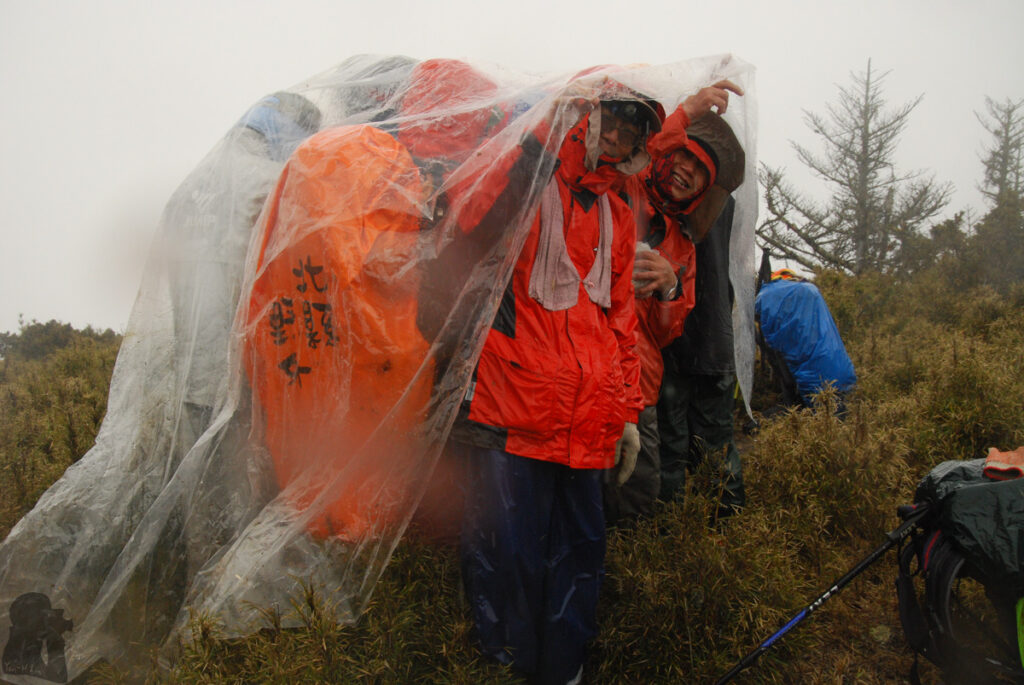
In fact, there are much more tips to prevent the development of hypothermia when you are exposed to the elements. One of the common suggestions is carrying an emergency blanket or a very big plastic bag which a hiker can stay inside while waiting for the help. Or use a tarp to set up an improvised shelter…But what really more important is that you must prevent yourself from falling into these wilderness survival scenes.
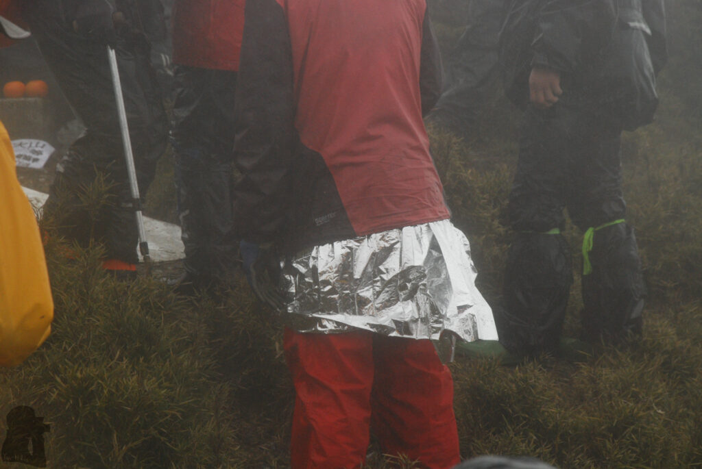
4. Altitude sickness, other illnesses and injuries:
Please find Q7 and Q8 for information about altitude sickness.
If you have certain medical conditions, please consult your doctor before your multi-day hike in Taiwan. You need to have all your personal medication with you during a hike. If you have musculoskeletal issues, consider if a hike, long hours walk with a heavy backpack in a harsh environment, may make them worse. Train yourself in a safer environment in advance and know your limit. My opinion in Q3 and Q4 might help for this aspect. When you just arrive Taiwan, get yourself familiar with the weather, food and maybe the culture first. Try to hike on some easier trails before a difficult one.
It might be beneficial if you have attended a first aid course, at least you could deal with some minor injuries. But if there is a serious injury, it is more about whether you can contact the professional to save the patient. Please read Q20 to Q23 regarding the communication in the mountains.
When you are in trouble on a popular trail, you may receive help from other strangers. But if you will go for a challenging hike at a remote location, having a high level of self-sufficiency is necessary. Even search and rescue crew know where your are, it is not unusual that they need several days to reach you. In some fortunate events, the hikers can be airlifted in a few hours if the location and the current weather is safe for the operation. However, it is often that a hiker is stranded deeply in a forest or a valley while nobody around is able to drag you out of danger. When the weather and visibility is poor, rescue team would not risk their lives.
5. River crossing:
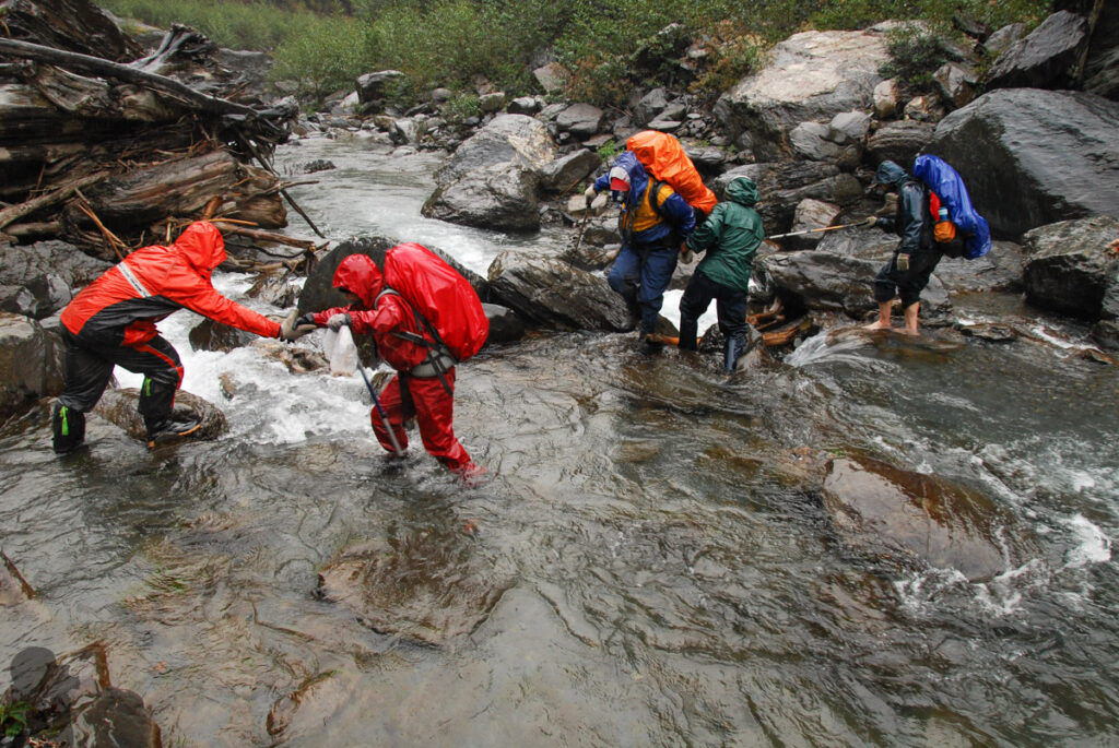
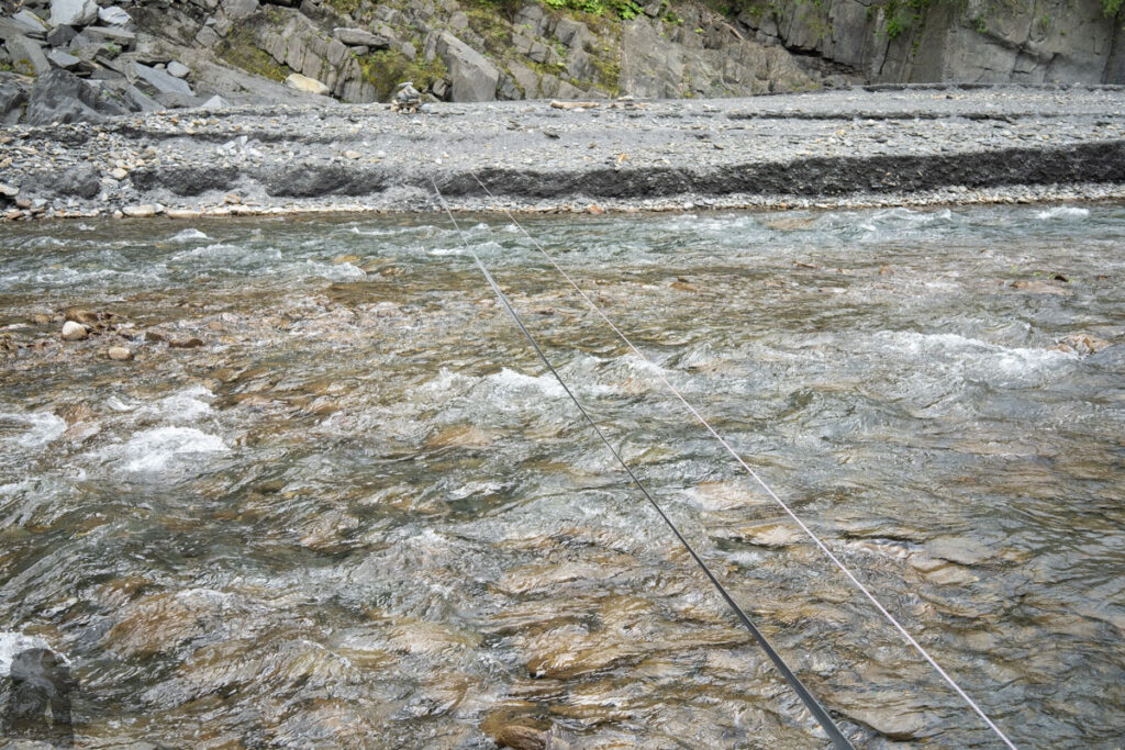
In general river crossing is a trail-specific risk as some hiking routes have sections that hikers have to cross a stream or follow it for a distance. It is common to hear a swollen river stranded people in Taiwan; Fast swelling river due to heavy rain also claimed lives in the mountains. You may learn these unfortunate events on the news such as this one.
Before a hike, you should know whether you need to cross or follow a river at some locations along this trail. If you encounter heavy rain during the hike, you may want to make an early decision to either take an alternative route or turn back if possible. Or you can wait on the shore until water subsides. In my experience when the river reaches thigh high, the resistance from the current becomes considerable. But not just the depth, the speed of the current and other factors also affect your safety. Please click in the video to learn how to cross a river safely. Many advice in the video is also applicable in Taiwan.
If you hike in a guided group, a skilled guide may carry a rope to help each other crossing the river. But this is not always feasible. In fact, crossing a rapid river is very technical. When a river floods badly even the rescue team may have to wait for a while until it is possible to bring you to safety
6. Falling rocks:
People might think the probability of being hit by a falling rock during hiking is very low but actually accidents such as this case did happen in Taiwan. Rockfall is a threat to anyone whoever is in the mountainous areas, not just the hikers. I saw small-scale rockfalls in front of me two or three times. We just waited until it stopped and swiftly passed the scenes. The likelihood of being injured or killed by a falling rock is definitely not zero. But there are several tips to minimize this risk.
Avoid going to any mountainous area soon after a strong earthquake or a heavy rainfall, which are the two important factors leading to landslides and rockfalls. The steep terrain in Taiwan further raise the probability of their occurrence.
Stay vigilant whenever you are underneath a steep slope or a rocky wall; even the slope above you looks forested, rock falling is still possible. Unfortunately a terrain prone to rockfalls is too common in Taiwan. So nobody could really be alert all the time. But before a rockfall or landslide coming in sight, there might be some unusual and scary noises first; you do not want your music or chat distract you.
Boulders / rocks on the ground is a sign of a rockfall-prone area, where you need to pass quickly. Do not linger or take a break there. Do not camp at the spot where you can see fallen trees, boulders or rocks scattered around.
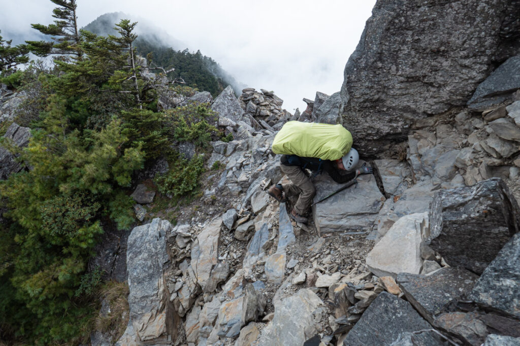
Falling rocks caused by hikers is a hazard too. Everyone may unintentionally kick or loosen rocks whenever moving up or down the slope. This usually happens while scrambling over a steep spot.
It would be safer to keep a proper distance from other hikers above you and pay attention to their footsteps when this may happen. When you accidentally kick a rock loose, shout immediately and loudly to warn all the persons below.
I saw more and more hikers in Taiwan wearing helmets. This is a good practice but also the last resort to protect you.

7. Landslide / Earthquake / Heavy rain:
Taiwan is very earthquake-prone. There may be over 1000 felt earthquakes in Taiwan every year but most of them were harmless. Earthquake is a part of the Taiwanese life. A disastrous earthquake might occur every few years, causing considerable property damage and casualties.
The primary concern for hikers are the landslides / rockfalls triggered by an earthquake. Hiking trails may be damaged or buried as well as everything on the trails. Earthquake and rainfall are the two important factors that increase the likelihood of the landslide occurrence. Each of the factors alone is enough to cause a disaster. A strong earthquake and heavy rainfall together definitely make this hazard more lethal. Not just the hiking trails but also the highways can be damaged, shutting down the transportation between cities and rural areas.
Nevertheless a major earthquake is not something I worry about while hiking in the mountains because the likelihood is low and almost unpredictable. But after a strong earthquake, I would not hike for a period of time, particularly if heavy rainfall or a rainy season has arrived or will be coming soon. However, you may never know how long you should wait until the mountains can “settle down.” The only thing I can do is to check the news or the update from social media in the hope of someone has been the pioneer to hike on those trails.
If you want to hike on an alpine trail in a national park after a big earthquake, please check their current status here. You can know whether it already reopen or not. A recent strong earthquake, magnitude 7.2, shook the whole Taiwan on 3rd April 2024. Infrastructure and some hiking trails in Taroko National Park were seriously damaged. Please visit their website for the update.
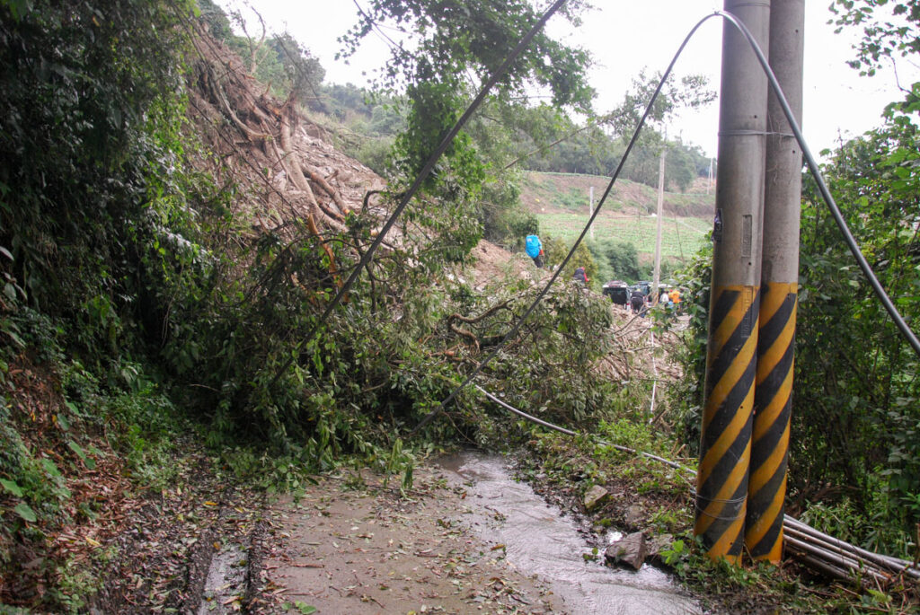
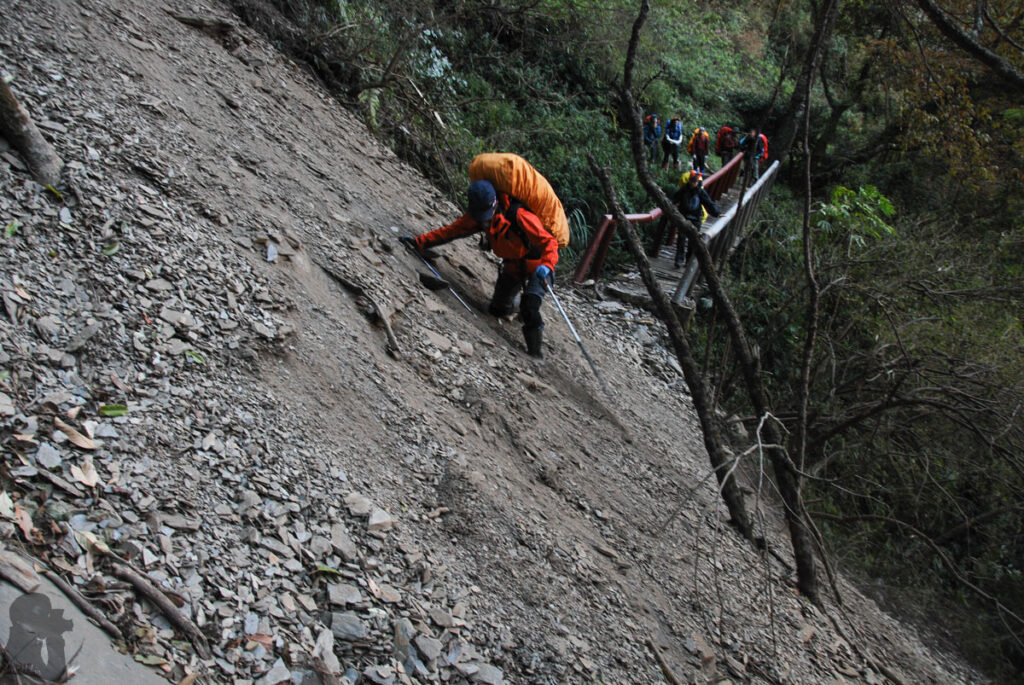
8. Lightning strike:
Some people thought the chance of getting struck by a lightning is similar to winning the top prize of a lottery. Even the likelihood is small, there were people seriously injured by this hazard once in a while including the hikers.
When you hike during the thunderstorm-prone seasons, you may have more chance to see the lightning. I actually only saw it once or twice from a distance when hiking in the mountains. So I was lucky to be unfamiliar with this hazard.
If you want to know more about the thunderstorm and lightning, here is the article.
You can tell how close a lightning to you by the time gap between sighting the flash and hearing its thunder. If you notice the gaps are getting shorter, it is the time you need to pay more attention. Hair standing on end is an urgent sign of a very near lightning that people must take actions immediately. Click to view the advice from Taipei City Fire Department to avoid this hazard.
9. Animals:
Hornets (虎頭蜂 Vespa spp.):
Hornets are the most dangerous animal on this list in my opinion. They attacked or killed hikers and outdoor workers each year. You can watch this video for more information.
Hornets are widely distributed in Taiwan, some species may inhabit the elevation up to 2500 m but most of them are under 2000 m. It is believed they are most aggressive in late summer and autumn (August to November). Although hiking at high altitude is less likely to confront them but many multi-day trails also pass lower altitudes and so we still have to watch their appearance.
I was chased by this fierce creature once when I hiked on Qilai East Ridge (奇萊東稜) in 2011. One teammate felt her face was sprayed with some “liquid (probably a pheromone)” and soon more and more hornets were coming toward us; we run away in a panic! I did not realize I could run so fast on a rough trail with a backpack hanging on my left shoulder. The lady got stung two or three times. Fortunately she was not seriously ill.
If I am going to hike on a hornet-prone trail, I will carry a head net with me. Once I spot a hornet I can put on the net over my head. That was a precaution I was told to do. Maybe the head net can protect the head / neck to a certain degree but I really do not how effective it is.
There are many advice / methods about how to avoid hornet attack and what to do when they swarm to you. I believe you can find more information on the internet but to be honest, I do not know which methods will work the best to minimize this hazard. If I see them, I would just move away from their territory as soon as possible. Do not piss off them and do not fight against them! Before a hike, consult your doctor and prepare suitable medication in advance.
This is the FB page where people report and share hornet-related information in Taiwan.

Formosan black bears (台灣黑熊):
This is an endangered species in Taiwan and there are only hundreds of individuals in the wild. I guess most of the hikers in Taiwan including me have not seen any one of them yet on a trail. One of the hot spots of their appearance is in the eastern region of Yushan National Park. Hikers on the eastern section of Batongguan Trail (八通關古道) had better shut the doors of the cabins all the time and keep the food properly sealed. Bears in Taiwan rarely attacked people but they may steal poultry / food and fight against dogs of farmland. In most of the cases when bears saw people, they just walked away or continued what they were doing. Only a small percentage (4%) of encounters that the bears stood to scare people. Even there are evidence showing their population is growing bigger and the occurrence is moving toward the lower altitude, I would not worry about this too much. Click to see the study.
For more information about this iconic species, please check out this page.
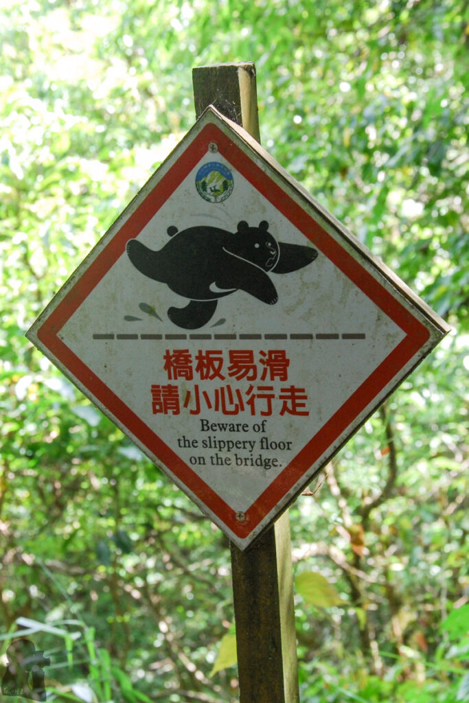
Monkeys (台灣獼猴 Formosan Rock Macaque):
In Taiwan there are way more conflicts between the monkeys and human than it between the bears and human. They have many populations and generally inhabit from low to medium altitudes but may reach up to the elevation of 3000 m. I did not spot them on the trails at high altitude but if a popular trail head is below 2500 m with the opportunities of getting food, it is possible that some monkeys are often there. A representative example is the famous Wuling Farm (武陵農場) in Shei-Pa National Park, where is literally a food court for the monkeys. The farm hires a squad using paintball guns to deter those aggressive mobs. On a recent visit I was advised to have my noddle inside their shop in stead of the outdoor dining area. As there was a shooter patrolling there, I had an exciting lunch by watching the guy defeated waves of invasion from the trees.
A very well-known trail in the city to see the monkeys is at Shoushan (壽山), Kaohsiung. Basically they own the mountain! They move individually or in groups around the people, jumping up and down the trees, sitting or resting on benches. Tourists are warned not to eat or even not to show a plastic bag because a plastic bag implies the food for the monkeys and they always take action promptly. The behavior of the monkeys is partially due to long term improper feeding by human beings.
Monkey are actually adorable if you watch them from a distance. To know more about these native inhabitants, click and scroll down the brochure for the content in English.
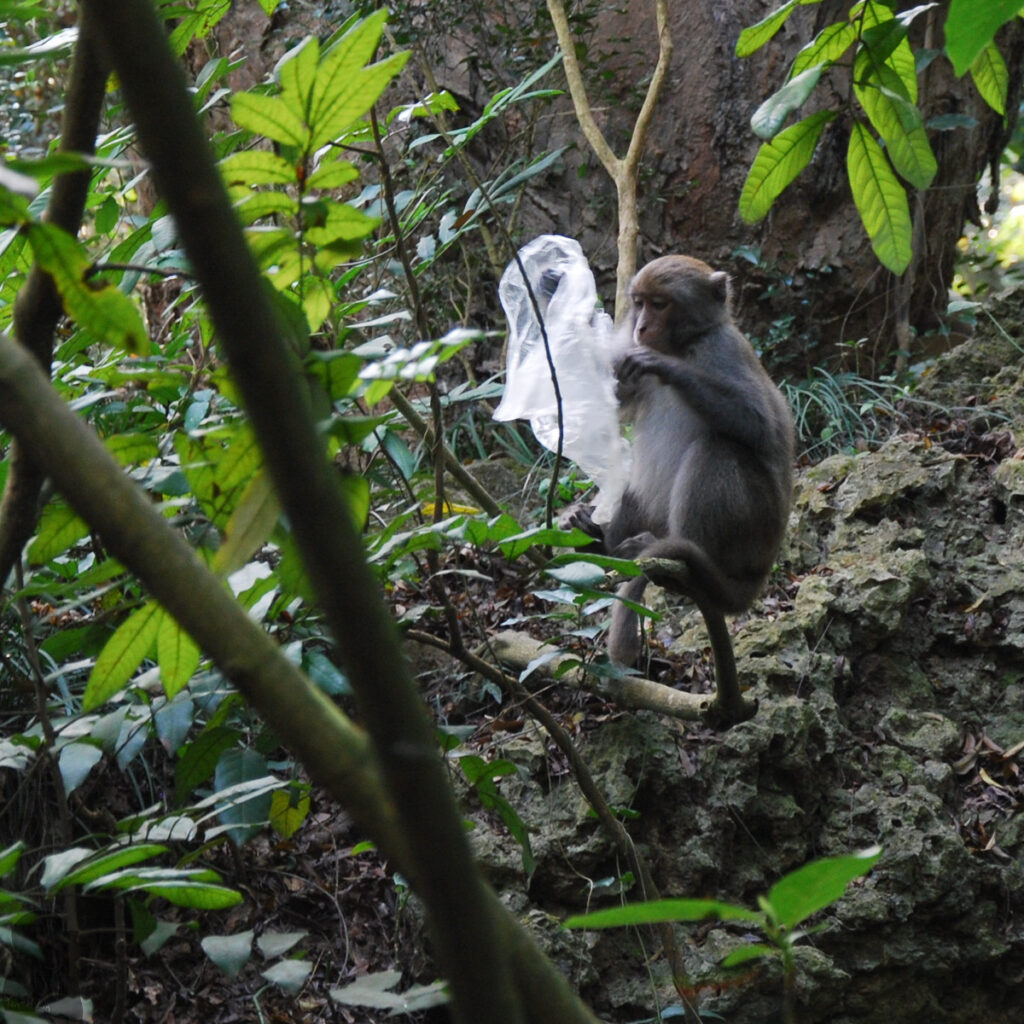
Rodents, weasels and yellow-throated martens:
These are the different species that often covet hikers’ food. They don’t eat hikers but their behavior is truly a nuisance. They are common around the cabins and the campsites, or wherever they may find some food.
During the nights you may hear rodents’ party noise inside the walls of many cabins. One of them even threaded on my face once while I was asleep. In some seriously rodent-infested cabins, hikers hang the food on the wires (but this does not always work.) or keep the food in the backpack as much as possible.
Weasels and yellow-throated martens have innocent look but they are the suspects of many vandalism in the mountains. Hikers frequently reported that their backpacks, tents or even the cabins were broken into; food package was tore apart, the backpacks got holed; leftover and broken packages scattered all over the floor.
The best practice is to carefully seal the food, leftover and rubbish. Remember to shut the door and windows and zip up the tents. So it does not attract these little robbers. Do not feed any wild animals. Watch the videos to know more here and there.
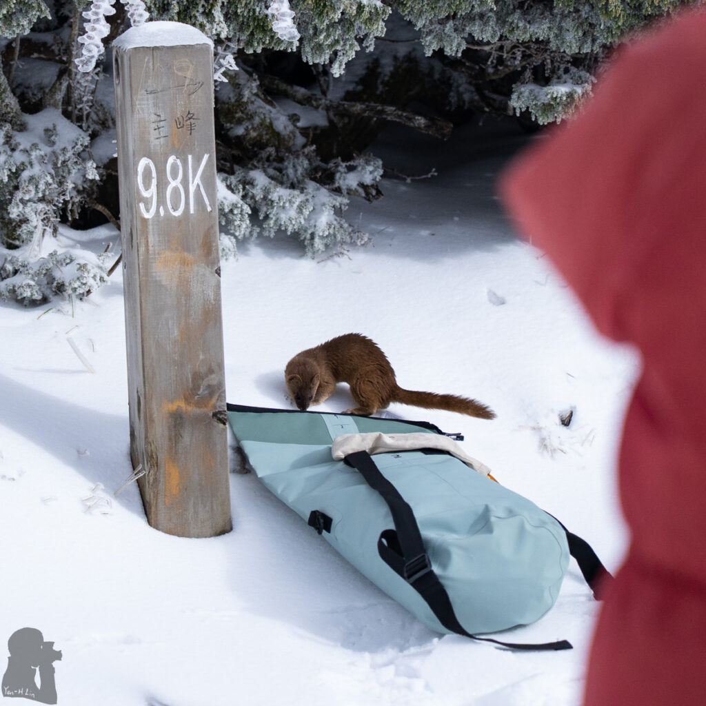
Sambars (水鹿 Formosan sambar deer):
They are probably the most photographed animal at high altitude in Taiwan. I have seen them many times. These deer are gentle and shy. When you approach them, they just run away. When you turn around, they may approach you but never get too close. You and a sambar may stare each other with a distance. The presence of hikers means the supply of salt and food for them. Many hikers in Taiwan know they rush to lick or chew the plants where people just take a leak. You may see them fighting for that.
Sambar deer may also steal food and touch your gears possibly for salts. Backpacks, clothes, boots and hiking poles are their possible targets. If you don’t want to lose food and essential gears while hiking, leave them inside the tent and zip up the doors. See what they did to hikers and the study of this animal.
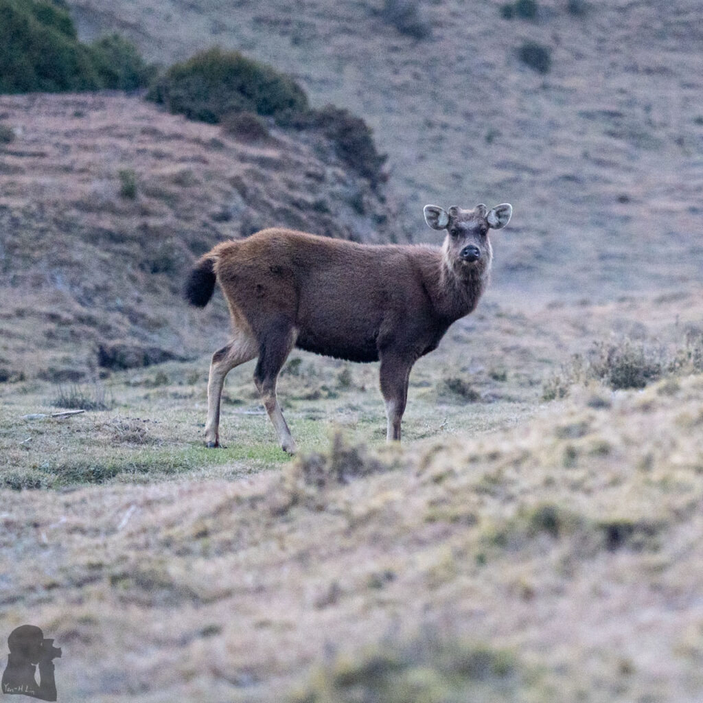
Venomous snakes:
There are a few species of venomous snake in Taiwan. The numbers of reported snakebites were around 1000 each year. But I only saw snakes for a couple of times (maybe less than five) during hiking in the past 15 years, all were at middle to low altitudes. They all left my sight so quickly before I realized where they were. I would guess that the likelihood of getting a snakebite, particularly by a venomous snake, during hiking is not high; actually I couldn’t even recall if any friends from hiking ever bitten by a snake.
Wild boars (山豬 Formosan wild boar):
Wild boars is a threat to crops (like bears and monkeys) and they become aggressive when being threatened. Locals may catch them with traps or hunt them with a team of trained dogs. This old article, published in 1987, is about the wild boars in Taiwan. Surprisingly, what this article describes is not much different from my current impression about the wild boars.
Anyway I have not seen them in the mountains even for a single time. I guess wild boars do not really like to stay in an alpine environment. Ironically and sadly the snare traps designed to catch wild boars are the real threat to hikers and non-target animals.
Dogs:
Many hiking trails or their trail heads are close to private land where the owners raise dogs to guard their orchards, greenhouses or other property from theft. These dogs are not friendly to any strangers. Once they sense anything unusual, they starts barking long before you can see them. Most of these dogs are chained or fenced off, but those free to move may charge and bark at hikers. I usually assume this may happen when I am getting close to a private property. So if the dog(s) suddenly turn up, I am not too scared. When I see the dogs coming toward me, I usually pause for a few seconds first and then keep walking slowly and steadily. Those dogs always let me pass and stop their deterrence once I move away for a distance. If the dogs look calm, I don’t even change my pace and just leave quietly.
A common advise is to remain calm when you face hostile dogs. Do not turn around and run because this may trigger their chasing / hunting instinct. Fortunately so far I did not need to wave my hiking poles to defend myself.
Stray dogs in rural towns, cities, parks or many touristy places is an issue which becomes more serious. They gang up and can be aggressive. There have been many cases that people and wildlife was attacked by them.
10. Disease:
Scrub typhus (恙蟲病) is not a very unusual disease after an outdoor activity (not limited to hiking). In Taiwan there were hundreds of reported cases every year. The bite by pathogen-carrying chiggers causes the disease. According to the CDC web page the symptoms include “an eschar over the bite” “persistent fever, headache, sweating and swelling or inflammation of the lymph gland” and “dark red papule in the trunk.” Please click the link and refer to the FAQs 2 of the article in the link for more details and the advice to prevent this disease.
If you are sick after a recent hike, it is important to tell your doctor that you have a recent outdoor activity and your travel history.
In spite of the possibility of getting this disease, I would not really worry about this too much while hiking in Taiwan. I am not sure if any of my friends have ever had this disease before.
11. Theft:
No matter how much people believe that Taiwan is a safe travel destination, disgraceful behavior like this does exist even in the mountains. I have no idea how often a theft may happen but sometimes I read that hikers who reported their personal belongings, gears and clothing missing at some cabins or campsites. I would assume this might happen more often in the places where you can meet more strangers (e.g. very popular tracks and cabins). I would also presume the items on the bunkers of a cabin are more accessible to a thief than they are in a tent. In addition to the wallets, it appears new, small-sized, light-weight and expensive products of famous brands are the primary targets based on my impression from reading the comments.
Losing anything in the mountains is not just losing some money, it is a threat to hiking safety. I don’t think anyone can propose a perfect solution to prevent this crime. But I would just keep those easy targets out of someone’s sight.
I am blessed not being a victim yet. It is probably because I have not stayed in any popular cabins for many years. In recent years I preferred to camp with my tent, which kept this chaotic world at bay.
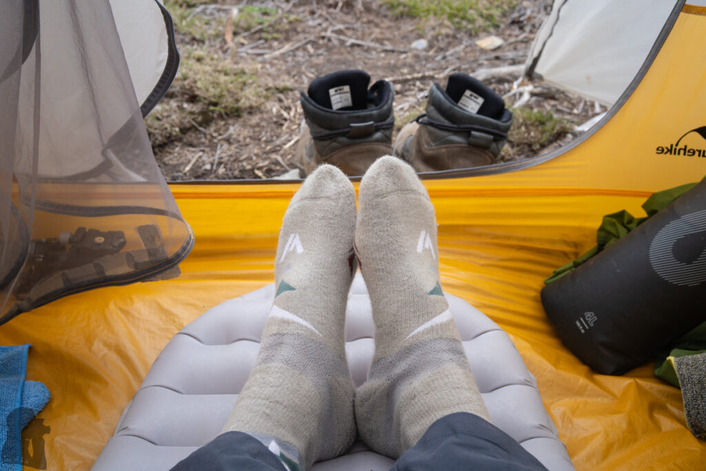
Hiking Trail Information (Q14 to Q16)
Q14. Any recommended maps for hiking in Taiwan? Is there a map in English available?
Before I introduce those maps, there are two things you may need to know. Firstly, there may be more than one English names for the same location in Taiwan. It depends on how people translate the name and the Pinyin system they use. Anyway, the consistency is poor if you search information from multiple sources. For example, the English names of the highest mountain in Taiwan (玉山) include Yushan, Yu Shan, Mt. Jade or Jade Mountain; Cijin (旗津) or Qijin means the same district in Kaohsiung City. This can be confusing to people not using mandarin.
The other thing is that any hiking trails shown on any maps may not be 100% accurate. Some hiking trails in Taiwan are prone to changes due to the severe weather and the steep terrain. There may be new detours or side trails to replace the damaged sections. You have to hike on the current trails by following the trail markers and use the latest GPX files to assist you.
For all hikers:
Rudy MAPs (魯地圖)
This is my most recommended offline topo map of Taiwan. It is free, compatible with various hiking apps on Android, iOS, and Garmin devices and get updates regularly. It’s the map on my Garmin device and Android phone when I hike in Taiwan. Please refer to Q11 to download GPX track files for your planned hiking trail. The app I use is Green Tracks (綠野遊蹤). You can switch the map languages between English and Chinese in the setting.
You can not buy the following paper maps anymore (unless for used ones) but it is still worth to mention this company’s contribution and influence on the hiking community in Taiwan.
Paper maps published by Sun River Culture (上河文化) was the best ones in Taiwan. This company published a series of comprehensive and detailed hiking maps in the past decades. Sadly they have shut down the business in 2023 because of the long downturn in publishing industry. And you need to read Chinese for using the maps. Here is an online sample (Yushan) of their maps.
In addition to the topography, their Baiyue (百岳 Top 100 Mountains) hiking maps provide the valuable information, the time needed for traveling each section of the trails. Those recommended travel hours are probably based on real experiences and thus is very useful to organize a schedule for most of hikers. In Taiwan, the time required to finish a trail or a section of a trail is the information more important than the mileage of the trail. This is because a difficult trail can take much longer to finish than an easier one and the difficulties among different trails or different sections of a trail may vary substantially.
Sun River Maps are so influential that the advised times for hiking is generally regarded as a standard, the so called “Sun River Time” (上河時間). Fast hikers in Taiwan usually mentioned they only took, say, 70% of the Sun River Time for a leg of the hike; likewise, slower hikers might say that they spent 1.2 times of the Sun River Time. Sun River Times of all the Baiyue trails are still available on their website.
However, it is important to know that the information about the trails and the traveling times on Sun River Maps is no longer updated (the latest version was published in 2020). As a few hiking trails are constantly changing, some new routes already replaced the old ones in recent years; or some sections of a trail may require more time to pass than before. You will not see those updates on their maps or the website.
Even so, the majority of the “Sun River Time” is still valid for planning all my recent hikes in the high mountains of Taiwan (2025). For the very popular and easy hikes (e.g. Yushan), I think that Sun River Time will remain useful for the coming years.
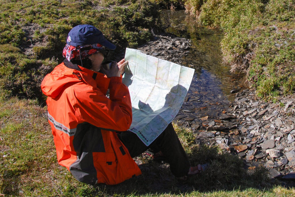
For hikers doing their research at home
Google Map:
You should not expect Google Map to function normally everywhere in Taiwan. It is not built for hiking. I often use Street View to locate a trail head around a city or the bus stops near a trail. Although Google Map shows some of the popular hiking trails in Taiwan but I have no idea about their accuracy. When you may hike outside of the mobile coverage, you need to download the offline map in advance. But because I did not use any maps from Google for hiking and so I could not comment on their reliability.
You can change language setting so the map displays the place names in English and Chinese together, which is a handy feature when you need help from a local. There are still many rural places which do not have a translation and some important mountains are not even shown on Google Map.
Windy:
I don’t use it for hiking, only for weather forecast. Lately I am surprised that its map shows English names of many mountains including the least-known ones in Taiwan. That is the only reason I mention it. Even you can see the hiking trails displayed on its topo map but I think you should not really trust them. Like Google Map I only used it when I had a mobile coverage. When the signal was poor, loading its beautiful interface took forever.
For advanced map users
地圖產生器 / 地圖瀏覽器: Some experienced hikers in Taiwan know how to customize, download and print their own topographic maps. You may want to check up their website and this article for a tutorial.
Or if you just want to look for the information from here.
The owner has run this website for many years and still updates it. You may be amazed by the amount of map layers and the massive information.
Q15. Where can I find the information of hiking trails from official sources?
The main website hikers apply for the permits: Hike Smart Taiwan Service
The website maintained by Forestry and Nature Conservation Agency:
Taiwan Forest Recreation (台灣山林優遊網)
The websites of National Parks in the main island of Taiwan:
Yangmingshan National Park (陽明山國家公園)
Shei-Pa National Park (雪霸國家公園)
Taroko National Park (太魯閣國家公園)
Yushan National Park (玉山國家公園)
National Nature Park (previous Shoushan National Nature Park)
Kenting National Park (墾丁國家公園)
Q16. Where can I find the information for a hiking trail from social media / website?
On Facebook
Taiwan Hiking Community: This is the page where people communicate in English
登山通報站: This is the page where hikers report the latest conditions of any hiking trails or share any information relevant to hiking:
登山借問站: This is the page where hikers can ask any questions related to hiking
The response or the advice you get from these places may be more useful and up-to-date than the information from the government websites.
Website
Hiking Note (健行筆記): This website is like a hiking database of Taiwan. You can find a lot of information there. I use it mainly to download the GPX track files for my hikes.
The Hiking Permits, the basics of this confusing task (Q17 and Q18)
Q17. Do I need the permit for a hike in Taiwan? Where to apply for the permits?
There are numberless hiking trails in Taiwan. Having a day walk / short hike on the popular trails around a city or a town can be something like a regular exercise for the locals or a sightseeing for the tourists. These are the trails which you don’t need to worry about the permit thing.
If you notice that your hike is a serious one (although it is tricky to define what is a serious hike), you should check whether you need one or more permits to hike legally. For example, if the trail is in a remote, rural, or mountainous area where you have to arrange transportation to access the trail head, or you can go to the trail head by bus but the bus only comes once or twice a day, or the trail is in a national park, or it is a challenging day hike or a multi-day hike. To my best of knowledge, you would need at least one kind of permit for any hiking trails that have one or more cabins along the routes (multi-day hike).
Actually the whole picture of applying for a hiking permit is complicated and confusing even to Taiwanese. If you join a guided hike or a hike organized by a company, club or an association, there should be someone to arrange this for you. But if you want to hike solo or arrange this for your team, I hope this section can provide some basic information.
Types of permit:
Park permit (入園證), issued by national parks, is generally for nature conservation. National parks only allow a number of visitors to enter some trails due to the capacity of the cabins / campgrounds and to minimize the impact to the environment.
Mountain entry permit (入山證), issued by the local police departments, is a policy derived from some historic and bureaucratic reasons. It is still required for hiking in many areas (but not all) in Taiwan.
There is also a special category of the permit issued by Forestry and Nature Conservation Agency (a different agency from national park); this is for entering the three types of the nature reserves. This agency also manages several their own lodges / cabins / campsites. Securing a bed or a campsite is the priority as they are located on very popular trails.
The website
The website “Hike Smart Taiwan Service” is the main official website to apply for all types of permits (but this is not the only official website to apply for different types of permit). It is an attempt by Taiwanese government to integrate the application for different authorities into a single platform, but there is still much to be improved there, particularly the English version.
If you will hike in a national park:
For some trails within a national park, you need to have both park permit and mountain entry permit to enter the trails legally. There are also trails where hikers only need one kind of permit. And there are trails where hikers can go anytime without any permits. For example, you can click this link to see which permits is necessary for the hiking trails in Yushan National Park.
You can apply for the park permit and mountain entry permit for the same trail together on “Hike Smart Taiwan Service.” This is the main website to apply for the permits for a hike in a national park. You may notice that only three national parks’ trails are listed on this website. These are the three national parks where many high mountains are located. Getting the park permit from the national parks and secure your bed of a cabin or a campsite is always the first priority because many hiking trail are very popular, especially during the weekends and public holidays. The number of applicants can easily exceed the capacity of a trail or a cabin.
If you will go to a trail in other national parks (e.g. Yangmingshan National Park), you should check their own websites separately.
If you will hike outside any national parks:
For a hiking trail or a mountain outside any national parks, you need to check whether it is on the list of “Mountain Entry Application System”, the website run by the police department.
To find the list, go to the tab “Mountain Entry Location Search” and click “Search for Destination.” You will see a long list of the English names of the routes / mountains / townships. If your hiking trail or any mountains you will climb along this trail is on the list, you should apply for the permit. This was the website I normally applied for the mountain entry permit in the past.
You can try if you can get this job done with the “Hike Smart Taiwan Service.” But when you click “Online Application”, then “Apply for Park Permit” and choose the category “Mountain Entry Permit from the National Police Agency”, you will find that on the step 2: Itinerary plan, the list under “Destination” is in Chinese.
I heard some hikers manage this permit directly in a police station near the trail head but I would prefer applying it online to save time. I also heard people ringing the police department for assistance because this online work was too confusing. Or you can ask someone who have done this before. Please refer to Q16.
I found this long article may be helpful if you are looking for a detailed tutorial about this administrative task.
Good luck! And have fun!
Q18. What may happen to me if I go hiking without a required permit? Is the permit really important?
A part of the reasons to hold the hiking permit is to comply the conservation policy by a national park or forestry agency. Too many tourists on the trials can lead to a negative impact on the fragile eco-environment. The permit guarantees the holder a bunker or a campground to stay overnight as these places have limited capacity. The permit also avoid some argument such as who has the right to use a bed on a particular date…
For some busy hiking trails (e.g. Yushan and Xueshan), there are park rangers or volunteers to inspect if all the hikers have the permit because the numbers of the visitors are often close to the track’s full capacity and this is to ensure the tracks and the facilities are used by the rightful hikers. If you do not have the proper permit you may be asked to turn back if possible. And you are likely fined and forbidden for a period of time to enter this national park. Your name as well as other violators’ will be posted on the blacklist on “Hike Smart Taiwan Service” website.
Actually in some cases you may not even see any other human beings during a hike from the start till the end. No one would know or care about if you hike with a permit or not as long as you do not cause any trouble. But once you or your team are stranded by an accident and need a rescue operation, you may incur some liability if you do not have the permit.
Holding the permit is like leaving an intention to the relevant authorities as you already submit a hiking plan to them. If you go missing, they would have a better idea where to find you based on your hiking itinerary. Before a typhoon coming, it is common to hear that national parks attempt to contact all the permit holders including those are already in the mountains; police officers may go to some trails and urge the hikers to return as soon as possible (P.S. this might be a situation that hikers without a permit are caught).
The communication in the mountains of Taiwan (Q20 to Q23)
Q20: Is mobile phone communication a possible issue when hiking in Taiwan?
Yes, communication via mobile phones does not work everywhere in Taiwan.
You can check the mobile network coverage in Taiwan by clicking this link and choose the coverage maps from the biggest three telecom providers. You will notice there are several major blank areas that have no coverage of cellular signal or 4G / 5G network. These are mainly the mountainous areas where you may not be able to make a call or connect to a network.
In reality the mobile signal still exists inside these blank areas but the signal strength is unstable and the distribution of the coverage is spotty. It is more likely to contact someone on the phone successfully at the peaks or along a ridge than somewhere lower such as a valley, a creek or in a dense forest. Even you get mobile signal in the mountains, it may totally disappear once you move a few steps away.
In recent years, national parks and forestry agency have put many signs along the hiking trails to show where hikers may have mobile signal. I found these signs are not a guarantee, they just suggest the possible presence of the signal.
Hikers are advised to stay put whenever they are lost in the mountains. Maybe this advice could be further amended such as hikers should stay at the same place where they still can communicate by phone.
If your cellphone can have two SIM cards installed, using SIM cards from different service providers might increase the chance of connecting to the network of either company. Although the mobile coverage maps from three major companies all look similar but there is still location-specific difference. One company’s SIM card can perform obviously better than the other one in a certain areas.

Q21: Is there any satellite-based communication in Taiwan?
Satellite phone
Before the satellite messenger, satellite phone was used to be the only tool to contact someone outside the mountains when the cellphones did not work. A professional mountain guide may carry it all the time, but for a casual hiker, hiring a satellite phone is a more affordable solution. I could not have any constructive comment regarding the performance and reliability as I have not used it before. But I think having some practice and even make a test call before the hike is necessary. The options to hire a satellite phone in Taiwan seems very limited. Here is the only company I can find. But I did not shop there before.
Satellite messenger
It appears that satellite messenger is the most recommended device among ordinary hikers. Currently the most frequently heard device is Garmin inReach Mini 2.
My first satellite messenger is SPOT Gen3, a discontinued device. I used it for several years in New Zealand. Overall, it was easy to use and very reliable. But its specification / functions already fall short of today’s standard.
My current device is Garmin GPSMAP 66i, a discontinued model as well, but it includes the inReach function, probably also an older version of inReach. Besides the satellite communication, it is my primary navigation device. There several key features which make this device very helpful when I hike away from mobile coverage. This is just a quick review based on my own experience (I am not sponsored by Garmin).
- Affordable price:
Even if you want to own the device, it does not cost an arm and a leg. The long term cost is from the inReach service subscription but you can suspend the plan whenever you don’t need it. Hiring an inReach Mini 2 is cheap in Taiwan but I have no idea if a hired one has limited functions. Please contact these shops regarding Garmin inReach hiring:
kawas
山旅戶外
馬布谷戶外裝備 Mabugu Outdoor Equipment - Two-way satellite communication:
Two-way communication means after you send a text message out, people who receive the message can reply to you. So you know that your contact has seen the message and you can get the update from them. This may sounds the way it is supposed to be. But when I used my old SPOT Gen3, I could only send a preset message and never knew if the message has been delivered or not and there was no way I had any reply. So the two-way messenger is absolutely a huge improvement. - Messages contain the coordinates:
This is very important particularly when your contact needs to report that you are missing or in danger. Knowing your last known location can make the search and rescue operation much more easier. - SOS bottom:
When a situation is too urgent or you are unable to send text, simply press the SOS bottom. Garmin Response Center will inform your local rescue department. There were hikers in Taiwan rescued in this way. - Tracking:
When you turn on this function, your locations can be sent out with an interval of every few minutes and can be displayed on the map in real time if you give your contact a MapShare link in advance; this is helpful especially when you are passing somewhere dangerous. - Weather forecast:
You can specify any location and obtain the weather forecast. I used this function many times to aid my decision-making during multi-day hikes.
PLB (Personal Locator Beacon)
PLB is a common equipment in New Zealand for mountaineers, skiers, people doing water sports or other outdoor activities. It can be used on land and sea. Basically it sends a distress message to Cospas-Sarsat satellites once you press the button.
The relevant information in Taiwan is scarce. I have no idea how well a PLB and, more importantly, the subsequent search and rescue network can work in Taiwan. Probably due to its price, regulation and the simple function, it seems PLB is not a common gear for hikers in Taiwan. I have not seen anyone carrying it during hiking yet.
In this case, people injured during canyoning activated PLB and got rescued. Here is a link to hire a PLB. But I strongly suggest you consult with the shop first.
Q22: What are the emergency hotlines in Taiwan?
119: for fire, rescue, and medical emergency
110: for police
Hikers can dial 112 when the mobile signal strength looks low or gone. If there is cellular coverage from other service providers, they will put through your emergency call.
Dial 112 and press 9 will redirect to 119
Dial 112 and press 0 will redirect to 110
Here is an explicit explanation from Taoyuan Fire Department
Q23. What should an emergency coordinator / contact (留守人) do?
When we are applying for a permit for a hike, we are always asked to provide the name and the phone number of our emergency coordinator / contact. Some hikers did this only to get the paperwork done but they did not even notify their contacts about the hiking plan. Or some hikers did not know whether their emergency contacts will be available during the scheduled hikes.
Having a reliable and contactable contact is a part of hiking safety. This person should not be your team member of this hike. Please make sure your emergency coordinator can:
- Have a copy of your permit and hiking plan in details, including the trail, schedule, transportation, the organization or the team leader, your health condition; have photos of you, your clothing and gears;
- Be contactable during the hike;
- Have regular communication with you, know your locations and share information to each other;
- Contact the authority if you are in trouble, overdue, or missing and offer relevant information to search and rescue teams.
Ideally your emergency coordinator has some hiking experience, which can be helpful when talking to search and rescue department. But it is fine if your contact does not know much about hiking as long as the tasks mentioned above can be done.
I did not use the following service before but I hope this information can be useful:
There is an online service (free service) called “Third-Party Collaborative Leave-Behind Platform (第三方協同留守平台)”, where you can provide your hiking plan and personal details to them. You need the app “LINE” to use this service. When you finish the setup and give them all the required information, the volunteers of the organization can act like your emergency coordinator. You can update your status on “LINE” while hiking. Please remember to let them know when you complete the hike safely.
This is the service promoted by a government agency, click to know more.



